Iceland trip 20...27-09-2012. Full gallery & Commentary.
Jump to: Day 2, Geysir Day 3, Hekla Day 4, Landmannalaugar Day 5, Landmannalaugar & Seljalandsfoss Day 6, Gigjokull glacier Day 7, Hengil / Keflavik
My flight left Luton at about 06.35 - (a HORRIBLE airport unfriendly staff, all stairs, trolleys cost £2 etc) - security insisted I empty my flight bag 'it looked suspicious' - I had packed so many things inside others to save space it confused the 'smart X ray scanners'! Annoying since it was packed like a 'chinese puzzle'. But interesting identifying all the items from the X ray screen image!
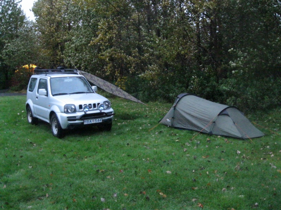
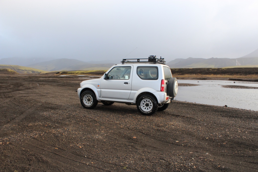
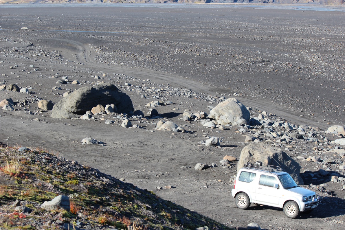
I flew into Keflavik airport at about 09.35 Icelandic time - Thursday 20-9. I had organised a rental Suzuki Jimny 4x4 'jeep' - modified tyres, suspension, chassis etc - from Adventure car rentals. This is an almost ideal car as it is small, has a very tight turning circle and is surprisingly rugged. The only disadvantage was it was a little too small to sleep in! Opted for extra insurance, GPS and emergency fuel tanks.
I completed over 500Km of 'off road' driving, I totalled about 1,200Km during the trip, and I am amazed the car survived, there were pot holes in the 'roads' that could swallow whole sheep. The Icelandic's call a track with marker posts a road in the interior! There are far more organised campsites than marked on any maps, rarely more than 30km to the next, except in the interior - but there it's free to camp anywhere - as long as you can be self sufficient - and are not in a national park area. Hiked a bit to see some rarely visited sights. I got very damp - it rained 5 out of 8 days, and every night bar one - what a surprise in Autumn only 400Km below arctic circle! Dried off at Landmannalaugar when 'trapped' there. Very damp again by the last day. Really appreciated the facilities at the last day hotel - laundry room etc!
Skies never cleared at night so I got all but shots of Auroras. Volcanoes, geysers, hot springs, glacier with bonus ice cave, waterfalls and some 'mars' and 'moon' landscapes!
This extended gallery is in the order I saw these sights, along with a brief commentary.
Day 1: Pingvellir.
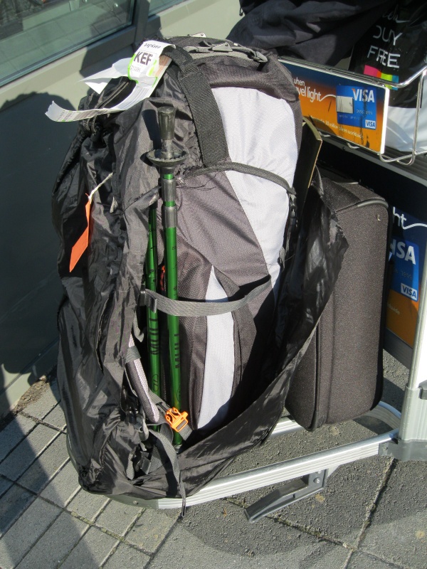
Started well on arrival at Keflavik airport - my rucksack flight bag was trashed by the baggage handlers - at Luton I expect!
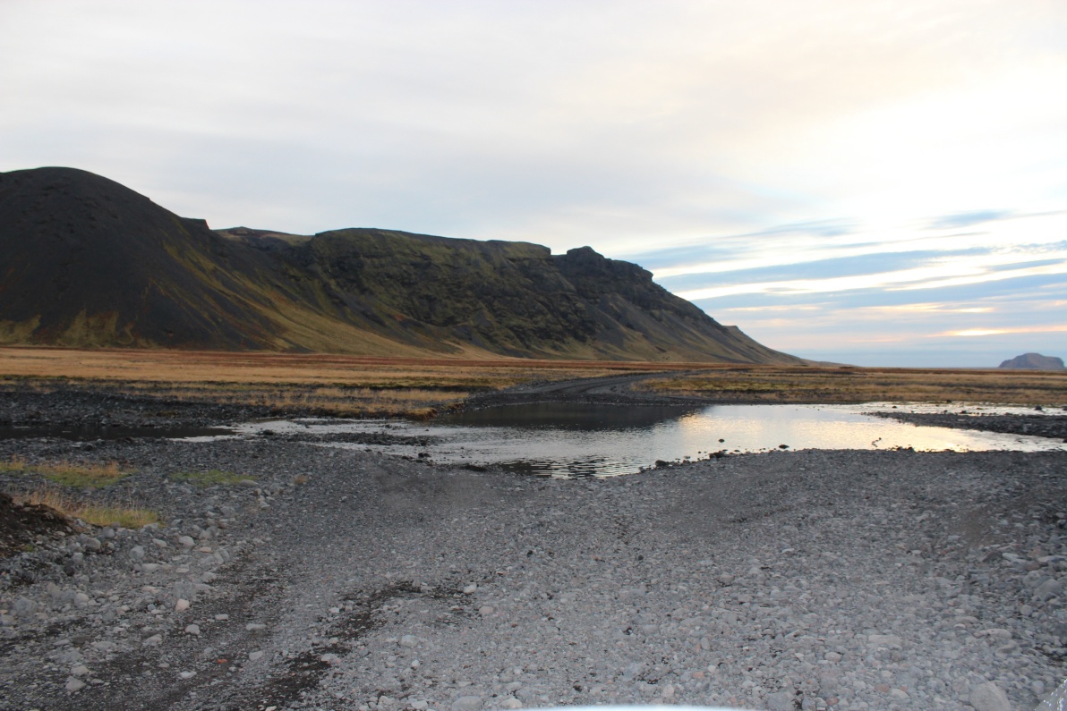
Driving to Pingvellir (Pronounced Thingvellir). Collected car from airport, they had forgotten the GPS and extra fuel cans. I followed them to their workshop near Hafnarfjorour on the outskirts of Reykjavik. Drove on into Reykjavik for shopping, Kringla shopping centre is very smart. Bought burgers, bacon, sugar, bread, camping gas, barbeque fuel etc. Prices not dissimilar to England but the selection and variety were very limited. Meat was as to be expected very expensive, large selection of dried fish. Got a data sim for my 3G internet 'USB stick' from the Vodafone shop after being advised 3G is available all over the island - it is not, there was barely a signal on the outskirts of Reykjavik let alone in the interior - too late to return it and complain. Drove an hour or so out of town, left hand driving a manual for the first time in over 10 years was OK.
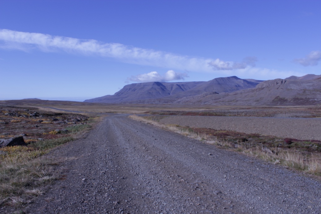
This is a side road off the 36 (main) road out of Reykjavic to Pingvellir national park!

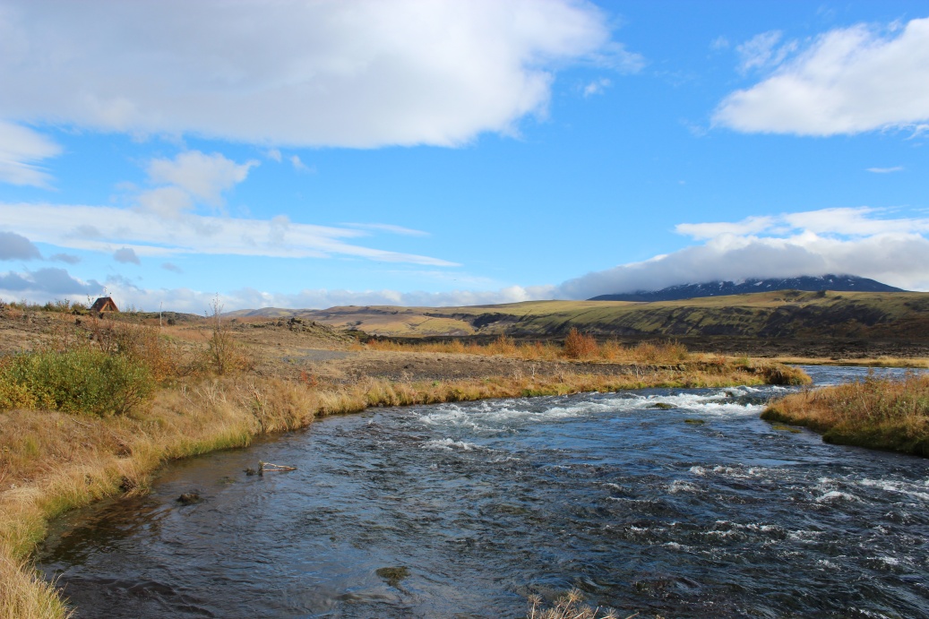
River running by and under 36 road.
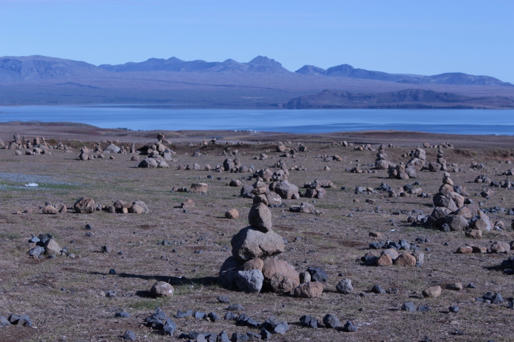
A few km further on and a field of cairns overlooking lake Pingvallavatn, I added one or two - the large one centre field is one of them.
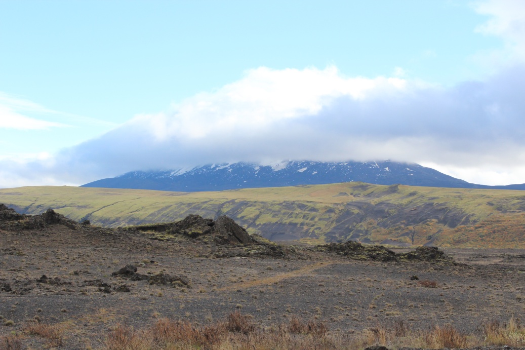
Lake Pingvallavatn, Skajaldbreidor volcano in background.
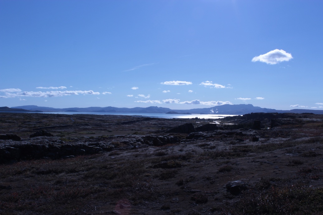
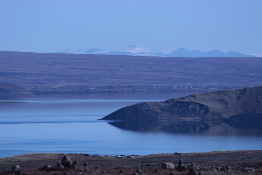
View of lake Pingvallavatn from other side - it was a glorious day, I almost got a lil sunburn!
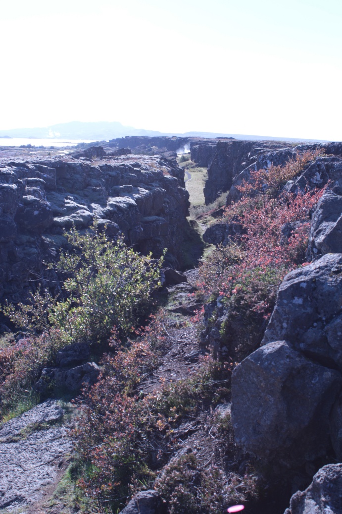
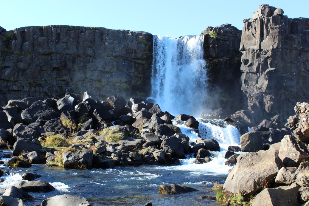
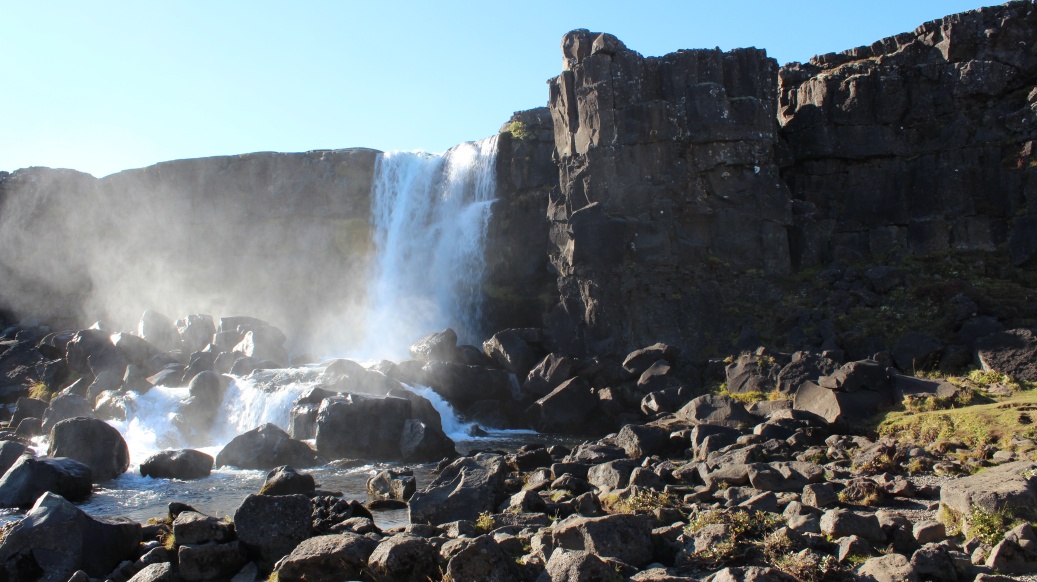
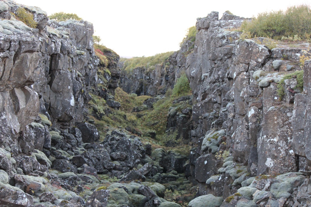
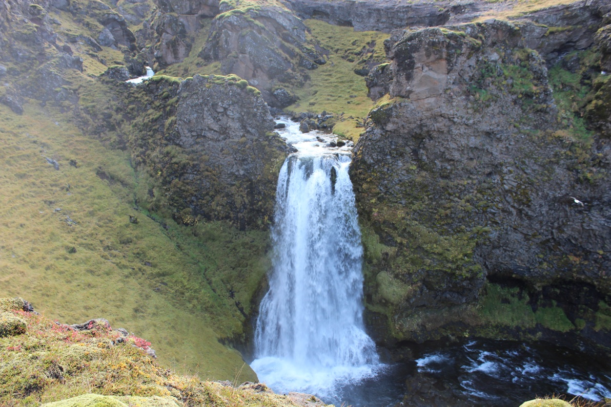
I arrived at Pingvellir national park, the continental divide, it was mid' afternoon. Parked car and walked into the gorges. Waterfall in distance.
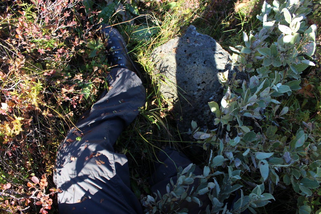
Clambering over the gorges you need to be mindful that the ground is ripped to pieces. I fell into a hole upto my hip - some ankle/shin grazing but nothing serious - I quickly learnt to be more careful.
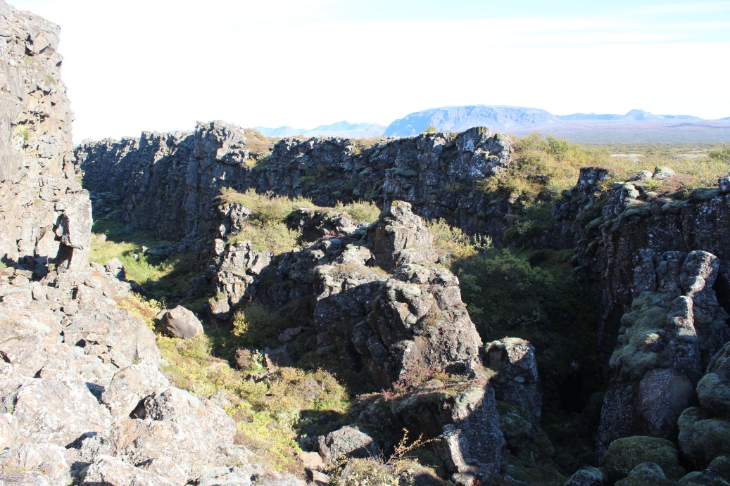
This is very rugged terrain.
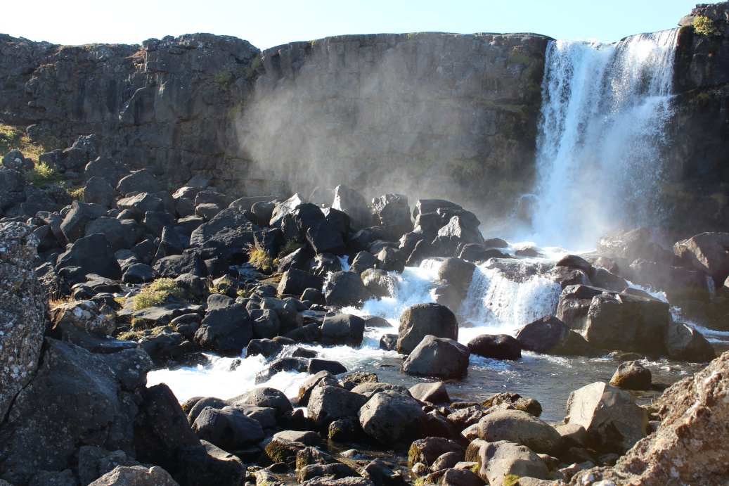
The waterfall, very loud and about 12 Metres tall. Subtle rainbow in the spray on right.
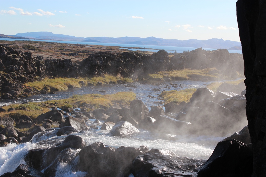
From 'behind' the waterfall a view across Pingvallavatn lake.
Another subtle rainbow in the spray.
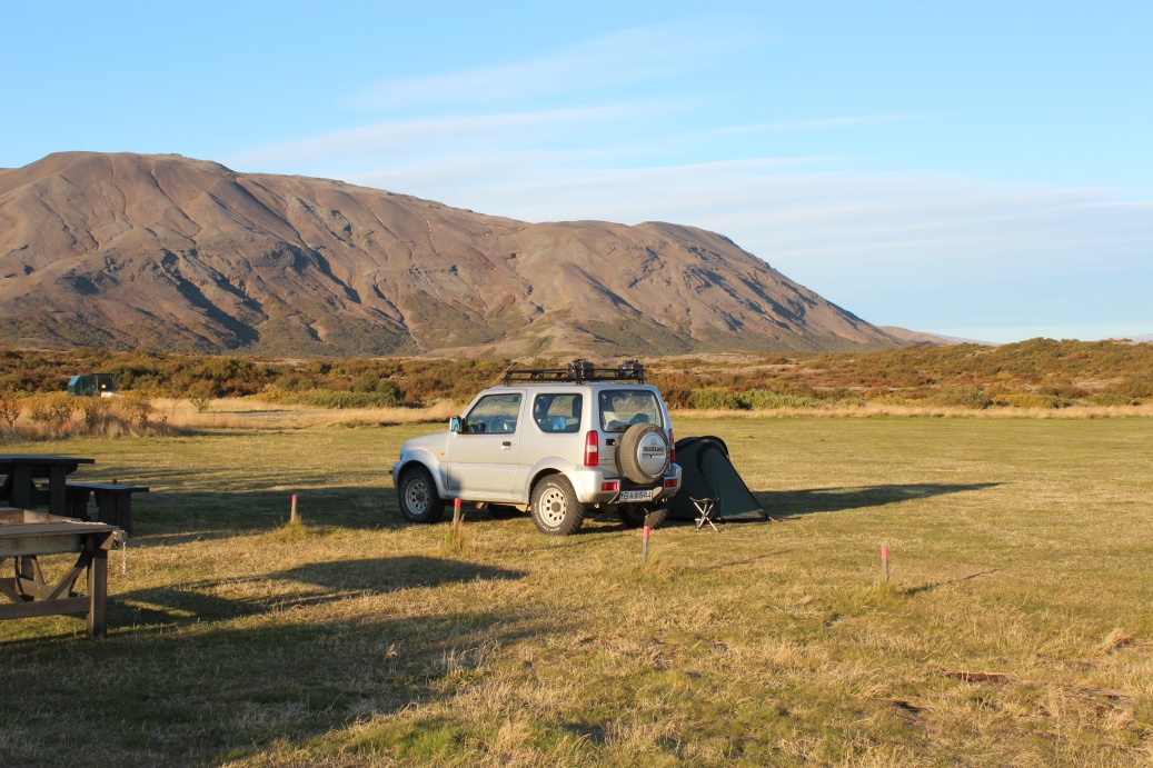
Campsite at Pingvellir. It was closed so the local ranger said I could stay for free. She did warn me it was going to rain and hoped I had warm kit. BBQ pit on left. Shower block with free endless hot showers. Drying room with free to use washing machine, powder provided onsite! A cafe about 100 metres away catering for the coach tourists - cafe will close for winter at end of September. A really nice campsite.
.
Late afternoon view from campsite.
Evening stroll down the gullies
Careful footing is essential as I found out earlier, the ground is just ripped to pieces.
The skies started clouding over at early dusk. I spent an hour trying to light the BBQ briquettes useless - ended up carefully soaking a few briquettes in petrol - that did it! I had BBQ Burgers. A car drove up, whilst I was cooking, stopping at the now closed cafe. He ran over to me and asked if I could speak English, he thought I was a local - great compliment. He was almost out of fuel and was beginning to panic! I explained I was English, did not know where the nearest fuel was and had not passed a petrol station since leaving Reykjavik. I had my emergency fuel but (perhaps selfishly) I was not going to let him have that - it was only my day 1. He left after I pointed out shortest route to the coast N1 road - settlements every few km along the N1.
3 French/Belgian girls arrived just as the dusk light faded. Finishing a 10 day tour of the sites accessible by main roads - they only hired a normal small car. The many of the popular sites are accessible by normal car, but they tend to be a bit 'touristy'. We had a few beers and a lil wine and they all crashed at about mid-night. It rained for a while but cleared about 01.30, around 02.00 I spotted subtle glows in the clouds - the stars are fuzzy due to the thin cloud but there is a definite glow behind them.
Little did I guess that this would be my best view of the Aurora! Crashed out at about 02.30 when clouds rolled in again.
Sleeping bag was warn, almost toasty. Outside it dropped to about 2C overnight with a little gusty drizzle before dawn. Tent was fine.
Jump to: Day 1, Pingvellir Day 3, Hekla Day 4, Landmannalaugar Day 5, Landmannalaugar & Seljalandsfoss Day 6, Gigjokull glacier Day 7, Hengil / Keflavik
Day 2: Geysir.
Next morning 3 tour coaches turned up at about 10.00, about 30 people in total, all were rushed back on board well before 12.00 - nowhere near sufficient time to see even this small place, most seemed to spend their time in or nearby the cafe - very odd!
Up at about 09.00. Warm shower at the excellent camp facilities. Breakfast of coffee and a huge bowl of porridge. The 3 girls were packed by about 10.00 and off to Reykjavik for last couple days of their trip. I had finished packing up tent etc and was on my way to Geysir by 12.00.
It had been raining on and off all night. By morning drizzle but increasing to light rain on drive to Geysir, the drizzle/rain did not stop all day.
Arrived at Geysir at about 14.30 - took a couple of pics of some small 'eruptions' and had lunch in the huge visitor centre and took opportunity to dry out a little, car was constantly misting up all back windows - almost dripping with condensation even with blower on full. Fast food bar, proper restaurant, gift shop, hotel etc - set up for tourist (bus) tours. The smell of sulphur was very strong in the air. All the tapwater in the facilities had a sulphurous hint!
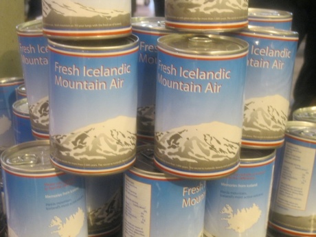
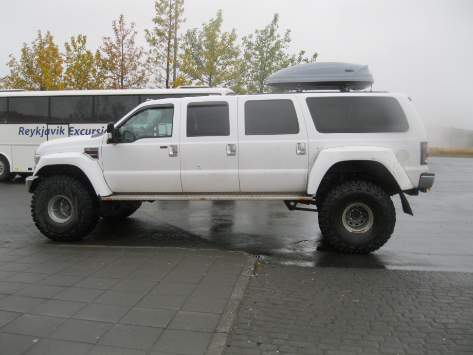
On sale at the visitor centre - a 'dream' product and outside the sort of vehicle a local tour operator needs if they are to go anywhere but the main roads.
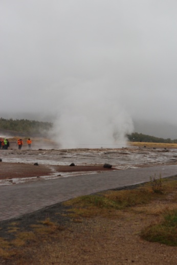
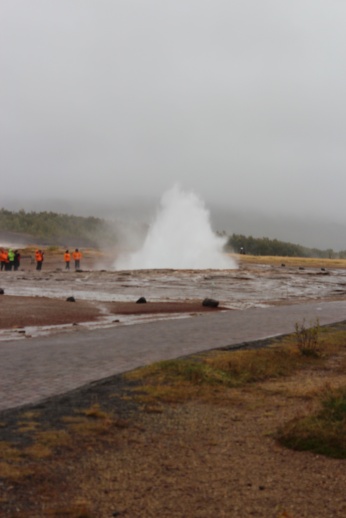
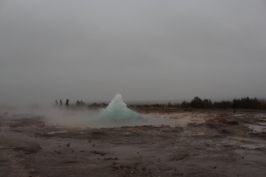
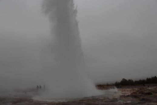
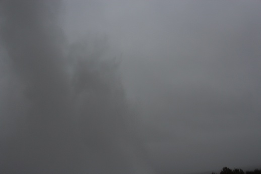
A typical eruption of the main geyser.
Even those prepared can get caught out - the eruptions are not often this large.
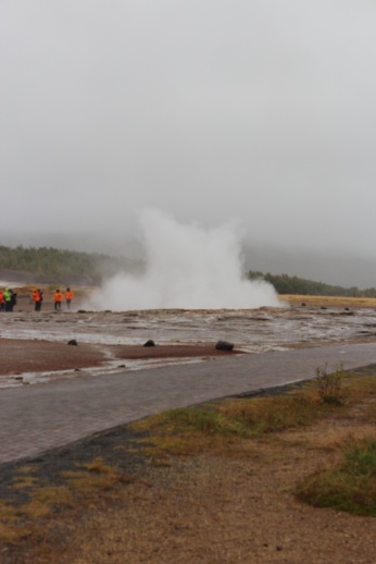
Tried to get a decent sequence, but the erratic nature of these things and the poor weather - it was drizzle/rain again - was not helping. Watch the tourists on the far side - why they were standing downwind I'll never know. They were prob' damp from the incessant drizzle but I'll wager they got soaked there!
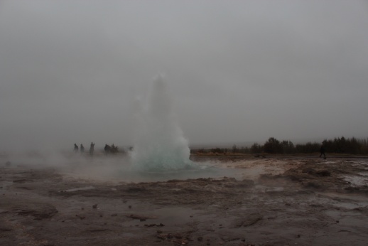
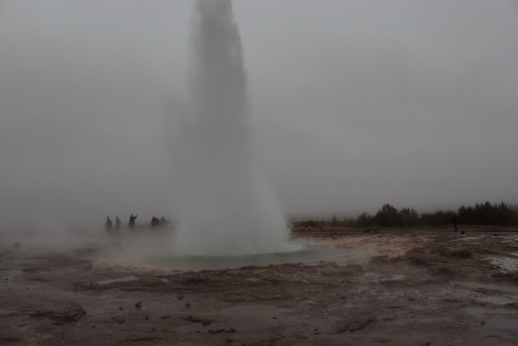
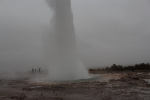
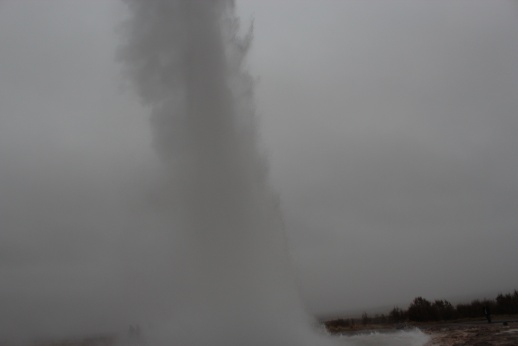
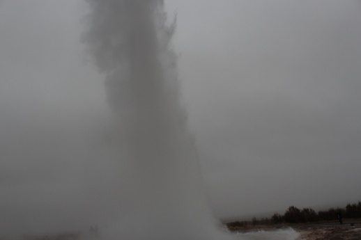

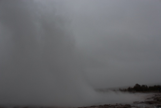
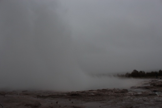
Tourists lost in the clouds of steam! That eruption went up about 30 metres, I was lucky the geyser was being very active - maybe the incessant rain was helping.
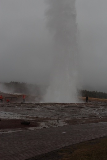
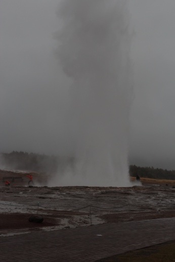
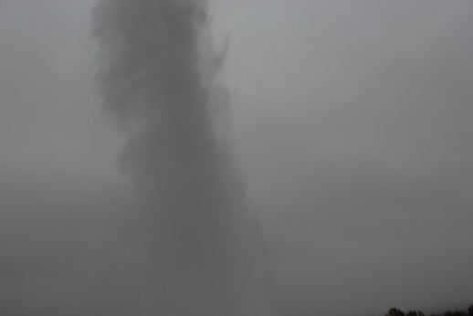
'Stop motion' animation of the geyser.
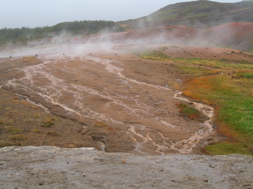
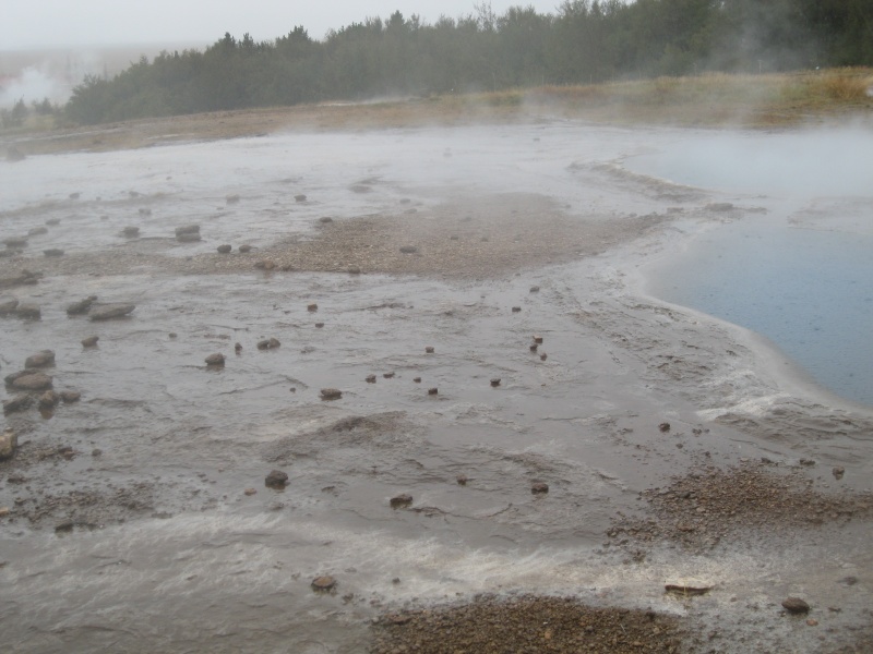
There were hot springs everywhere and the ground was constantly steaming! Made the landscape wild colours! The smell of sulphur was very strong here.
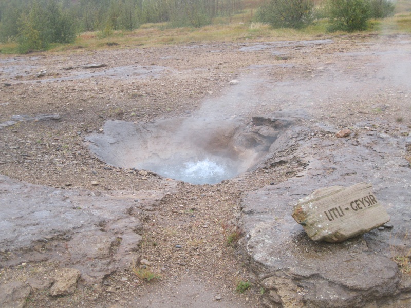
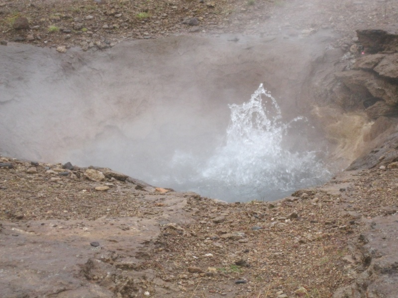
A small geyser - Little Geysir - did little more than vigorously boil, excellent for boil in bag rice etc! Though too many people around to try that for real! Drizzle is getting heavier.
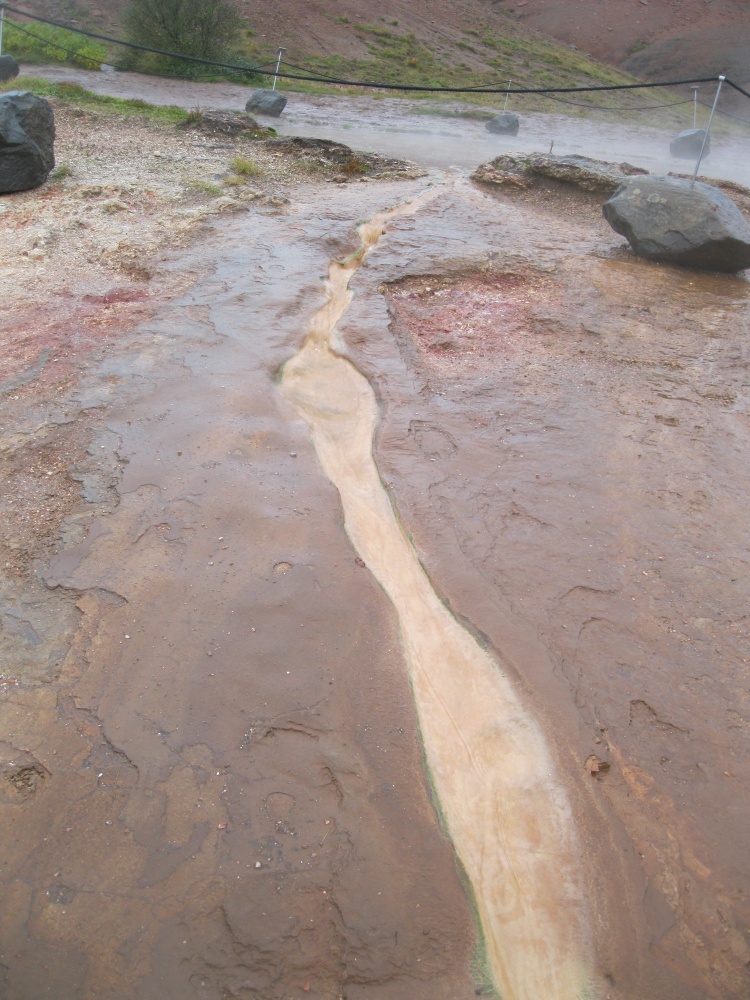
The runoff from the geysers was depositing minerals of reds and browns - the water was almost too hot to touch even after running for 10's of metres.
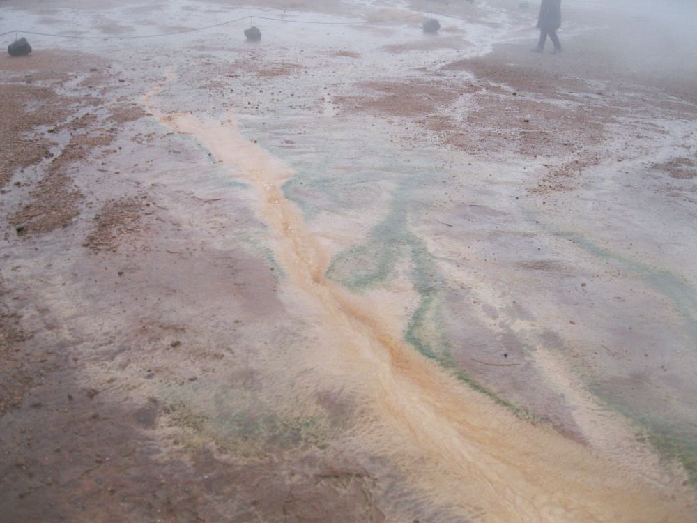
Some algae seemed to like the hot toxic water!
Spent too long at Geysir and made a run for Hella near south coast - ran out of time after sat nav sent me in very wrong direction, up main road to where a bridge had been washed out - I then realised I was in completely the wrong place - relying on sat nav rather than trusty old maps! There is a trace map of my route at the end. I found a campsite on the edge of a town called Laugargerdi. Erected tent in the dark.
I learnt that many of the place names on the maps of Iceland refer to tiny communities and even individual farm houses, & without the 'special' characters the sat nav got very confused - I soon got the hang of it though.
Free shower but no wash or drying rooms. Shower had very strong smell of sulphur. Hot water was direct from hot spring so no heating costs. Showered, the drizzle stopped for a while so I BBQ'd a couple of burgers - very difficult to light dampening charcoal so I used the gas stove to 'cook' 3 briquettes until they were well alight, that got the rest going - with dried pasta mix side dish. Started drizzling again, did not stop all night. No chance of any aurora tonight!
Everything is starting to get damp. Still not cold, about 3C overnight. Still toasty in dry sleeping bag, tent working fine. I think my sleeping bag was the only dry thing I have - my priority at the time having lost the battle to keep everything else dry - even my cell phone had visible condensation inside the screen!
Jump to: Day 1, Pingvellir Day 2, Geysir Day 4, Landmannalaugar Day 5, Landmannalaugar & Seljalandsfoss Day 6, Gigjokull glacier Day 7, Hengil / Keflavik
Day 3: Hekla
Porridge for breakfast at deserted campsite. Warm shower and back into damp clothes - no chance of drying anything here! There was a sign up indicating 1,000ISK (£5) to camp. On leaving I spotted a guy watching the entrance from the nearest house. I asked if I should pay him for the overnight stay, he reacted a little oddly but took my money - ho hum, no idea if he was the camp attendant but I paid so my conscience is clear. Decided to drive up towards Landmannalaugar passing Hekla on the way. The weather was clearing, light drizzle blowing in and out.
Next morning after cooking breakfast at Laugargerdi campsite between drizzle showers. Fjelduken (Useful combination poncho, 'bivvy' bag and makeshift shelter) as an awning to keep the rain off my cooking.
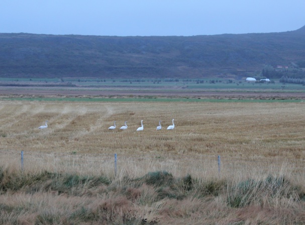
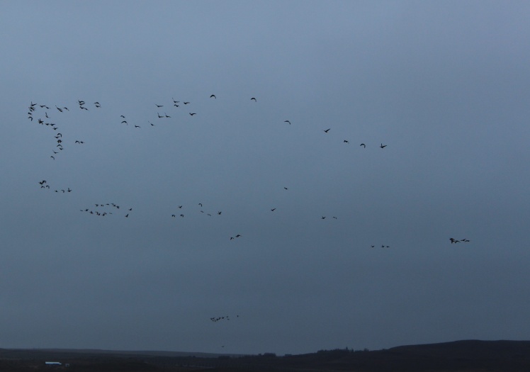
Wild swans and migrating geese seen from junction of the 1 & 264 roads. Upto this point I had been on paved roads the whole way.
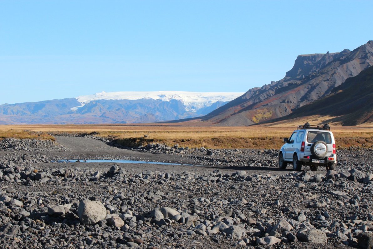
Driving up 264 to the 268 road towards Selsund - raining hard again and river fords. I had never forded a river in a car before! Luckily a local was a few minutes behind and he showed me the way, and a lil advice that was appreciated - just reinforced what I had read, low range, and commitment - do not back out half way or you will fail!
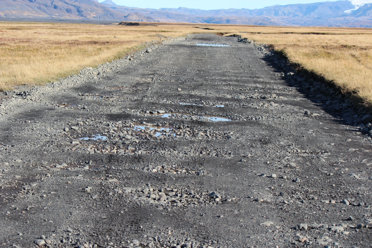
The distance to a site is no indication of the travel time. Any road with 3 digit number is little more than a track, and some 2 digit roads are nearly as bad! The 'F' roads are for 4x4 modified vehicles only - that is why I rented one! So my average speed was down to below 25Kph, and some pot holes still bottomed out the suspension of you were not quick to dodge them - not easy when constantly distracted by amazing scenery. I was stopping every few Km so my average speed was only 20Kph or so!
Raining hard again at the ford.
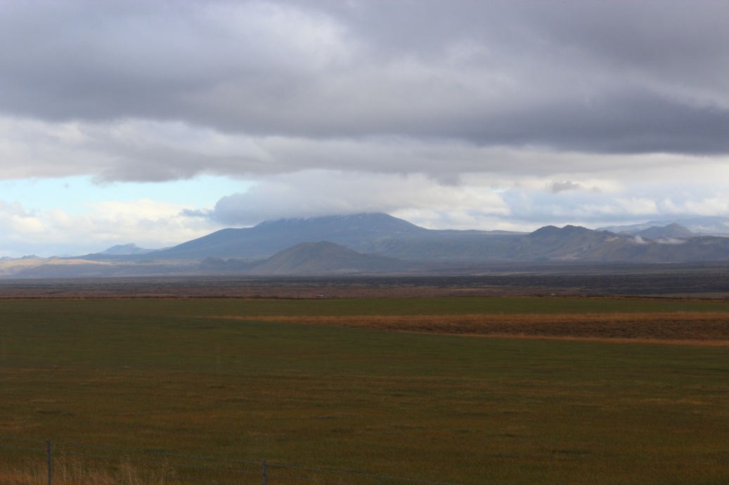
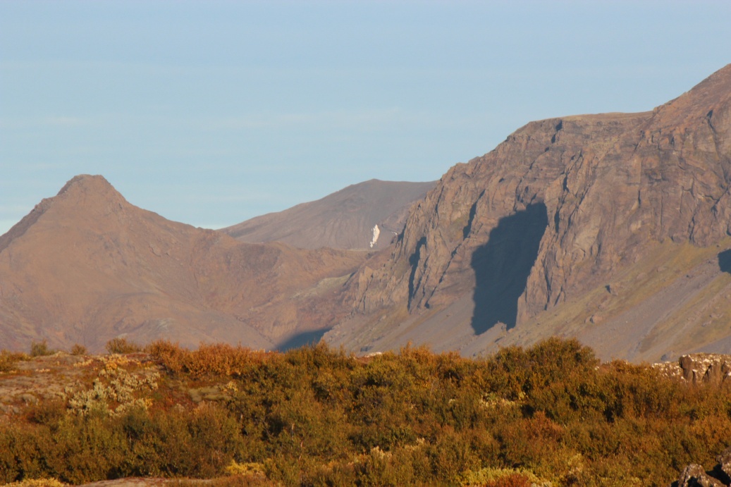
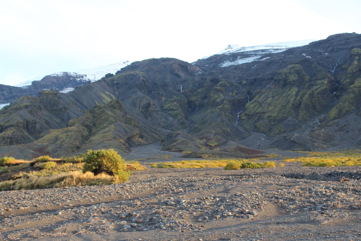
The skies cleared for a few minutes and Hekla came into view - not too far away! Do I dare try and get up there?
Further up the 268 the skies are obviously clearing and Hekla is getting closer.
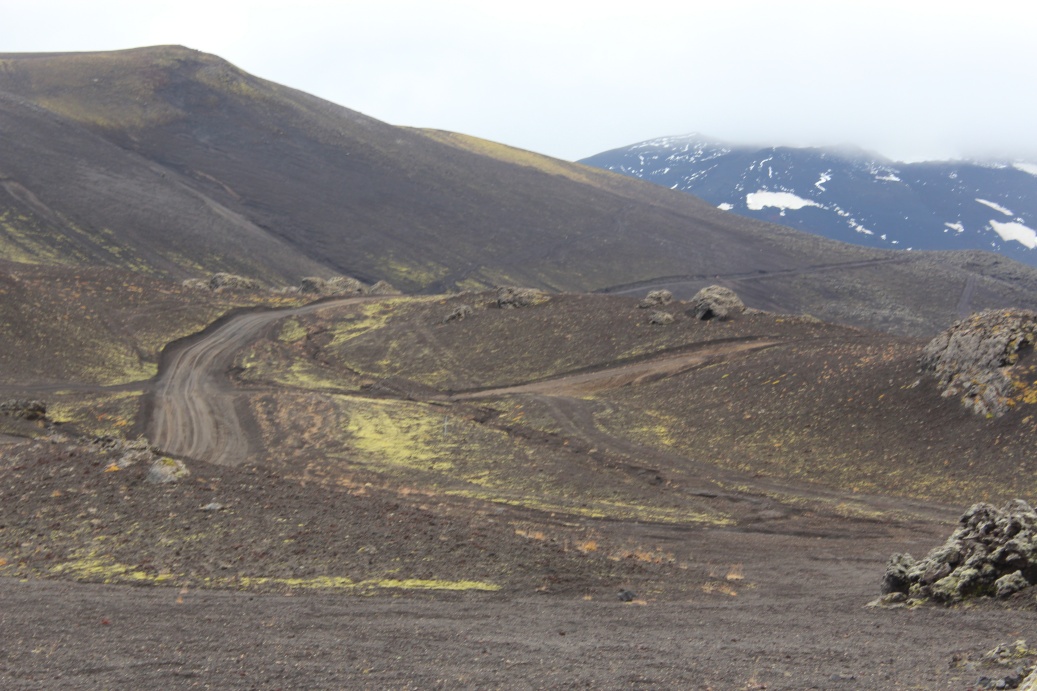
The F268 'road', in many places it was little more than a layer of lighter gravel where vehicles had cleared and crushed the pumice and ash.
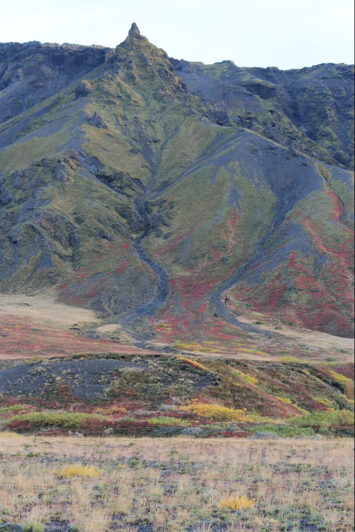
Found this spot just off the 268 - private cabin on bank of river with views of Hekla. The skies are definitely clearing.
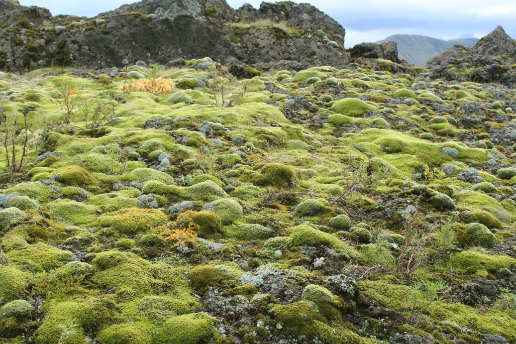
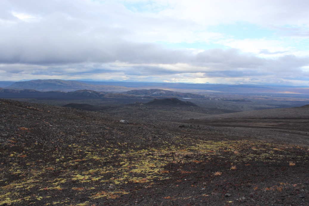
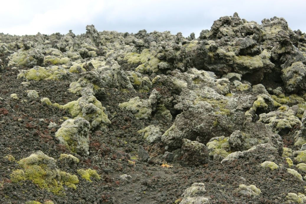
Mossy rock - this is a land of moss, very few higher plants in the interior.
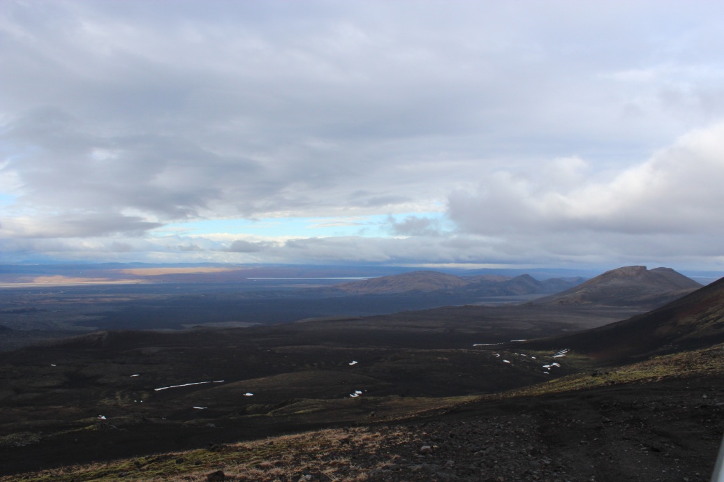
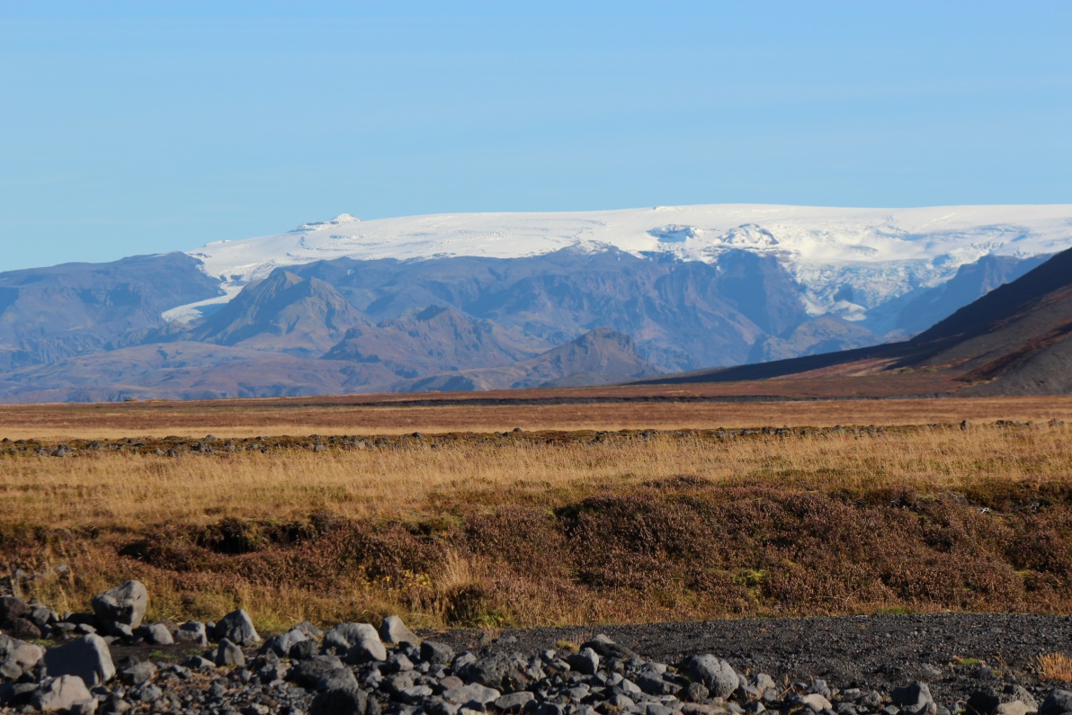
On the ash plain on the drive up towards Landmannalaugar.
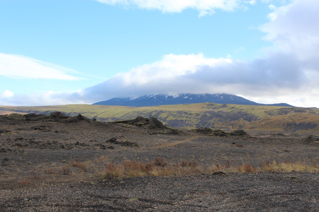
Clouds are clearing fast - its sunny and mild - this is my one chance to get up Hekla. The top still obscured by the 'cap' cloud but it is rising slowly. The 'left shoulder' is visible and that is where the track goes - I think.
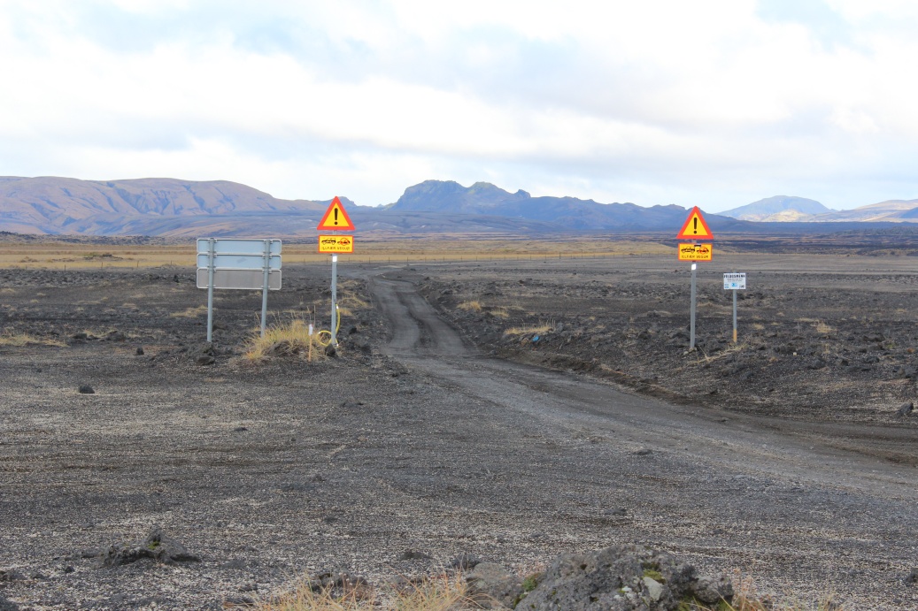
Take this 'road' at your own risk - modified 4x4s only! What about the last 40...50Km? Now the Jimny 4x4 comes into its own!
Took minor signposted track to Hekla, working my way up the outer slopes. Lava pebbles, ash and pumice made for a very slippery, loose surface. The car was always slipping and sliding a little - not too much but sufficient to keep my attention! Once in 4x4 low range I had to stop, engage neutral and double clutch to de-select low range, not practical on these slopes so low range all the way!
Higher and higher. The track was VERY steep in places and still made of loose lava 'pebbles', I was using 1st and 2nd in low range all of the way up, and tyres slipping a lot of the time! The gearbox started to overheat and I lost synchro' on first and second - double de-clutch became the rule - I did not want to trash the gearbox up here. Anticipation of the road and slope ahead became critical, sharp banked switchbacks and sudden very steep slopes - double de-clutching is a slow way to change gears!
Getting nearer the top. The wind was howling but the drizzle had stopped. The occasional 'flatter' bit up here allowed me to rest the car - the gearbox was seriously overheating - and calm down my adrenaline level. This was an intense almost scary drive. Think I may be on the lunar uplands now!
Views from top 'shoulder' of Hekla. It was blowing a gale, car was rocking and there were ice crystals in the wind (ouch!).
View back the way I had come up - it looks so tame here but it really was not (I don't have the photographic skills to show the reality of this place) - it was wild, loose, bumpy, very narrow track, gale force winds and blowing ice crystals - it was intense!
Just a few hundred metres further and the road goes along an exposed ridgeline.
West view into a side vent from beginning of the ridge. Car was unstable in the wind and the ridge was all loose ash and 'gravel', I only spent a few minutes there - long enough to confirm that going further up was a really bad idea! It was hard enough to stand upright without hanging onto the car.
A little way back down the ridge, a lot less windy, the view the West side back to the valley and Selsund further down the valley.
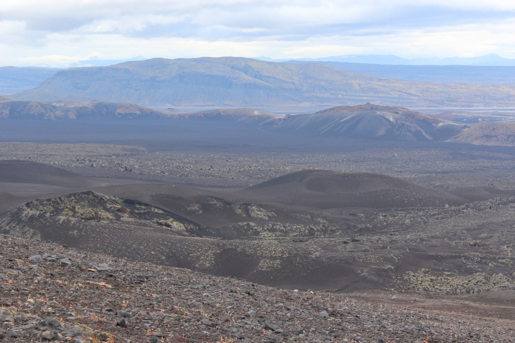
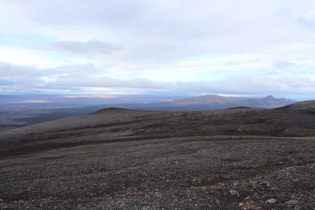
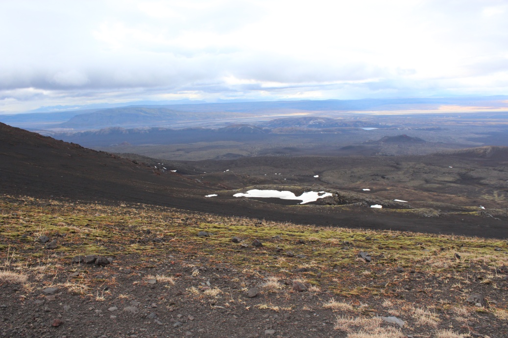
View East of ridge towards Vatnafjoll at 1230M, high peak on left almost obscured by the 960M ash cone in foreground, and Laufafell, broad 'tripple' peak left of centre at 1164M - I'm at about 920M and starting to get gusts of misty clouds - I am very near the cloud deck and I think its falling! I am reluctant to have the camera out too long what with the wind driven ice crystals and mizzle, and the rapidly forming condensation on the INSIDE of the displays and viewfinder! I should have bought a 'rain bag' for it! This is a wild place!
After checking the images and my GPS tracker I grabbed this image of Hekla from Google Earth: If you go on Google Earth zoom into maximum the track I took is just about visible - I started at about 460M on the 'road' junction, went down to 400M after about 5Km and ended at 920M. The driven distance from the junction to where I stopped is approx' 10Km. The track continues right up to the crater but Google Earth gives no impression of the daunting reality of that last few km..
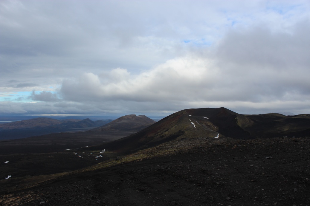
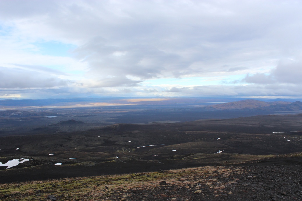
On the way down Hekla paused for a while by a 'mouldy' lava field. I needed to seriously reduce my adrenaline level - the drive down felt worse than the drive up Hekla - but I was grinning 'ear to ear' all the way down to the ash plain. Gearbox was not healthy but I did not need low range going down - just all in first or second, and hope the brakes hold out.
Looking back at Hekla from the track down - leaving when I did was good timing, the clouds had started to roll in again.
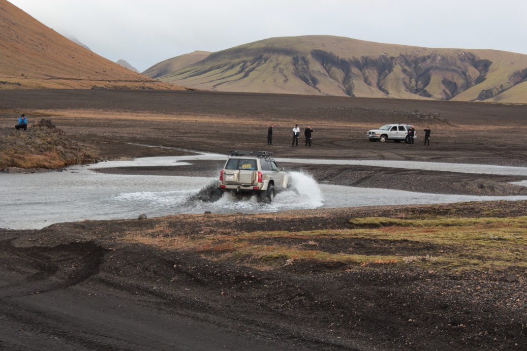
Back on the 'main road' to Landmannalaugar I met up with some locals 'playing'. Mercedes on right had managed to cross this ford, but it had 10cm of water on the floor and the engine was spluttering from water intake! The jeep in the ford was an 'Icelandic' special - big tyres, raised suspension, snorkel etc so no problem for him. He was confident my lil car would be fine and I'd seen the 'shallow' spots when they were having fun. After taking pics I could not find the car keys! All pockets checked many times etc! Walked and re-walked all the steps I had taken - easy to follow as the gravel left good prints - nowhere to be found! They had fallen between my waterproofs and my trousers when I 'missed' the pocket, and had lodged in lace loop of my boot! A significant feeling of relief followed!
I crossed the ford there, it was deep but the lil Jimny just chugged through - low range 1st gear and a bit of commitment! The road was more a riverbed for a few Km! Cleaned the car nicely though, and huge fun with the 'bow' wave nearly over the bonnet at times. Amazed how little water gets under the doors.
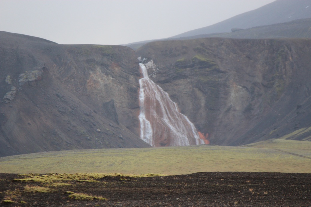
Hot spring waterfall near Nyjahraun, visible from the F225 track on route to Landmannalaugar. Drizzling again, but much less wind on the ash plains.
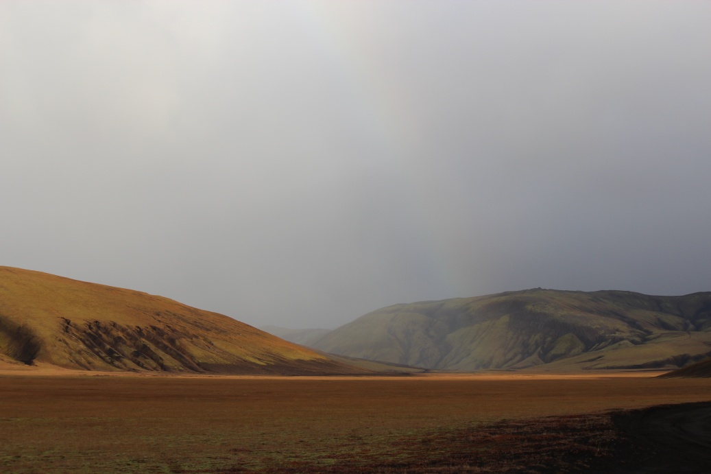
On the road to Landmannalaugar, a break in the clouds and a subtle rainbow across the hills.
Reached Landmannalaugar at 18.30 ish - it was now raining hard - put up tent on highest area of the campsite but it was still a bit of a quagmire. A young couple Fred and Allegra arrived a few minutes later, put up tent on nearby pitch. BBQ fuel was damp and would not light so had fried burgers and bacon. Side of Spicy potatoes. Used Fjelduken as an awning between car and a BBQ pit, helped a bit whilst cooking but would not really stand up the increasing wind, so I took it down immediately I finished cooking. That night it rained intensely and the wind picked up to a gale. I spent the night catnapping listening to the rain spattered mud blowing under the outer flysheet and making the inner fly muddy - drank bottle of merlot overnight. At 08.35 a tent peg failed - I heard a change in the tent noises - not surprised the ground was now officially a marsh/bog with footsteps leaving puddles - I had rock and standard pegs - not soft ground pegs. With the missing peg the wind was making the tent 'flap' badly so I abandoned and by 08.45 I had all in car. I am now really damp through - amazingly still keeping the sleeping bag dry.
Jump to: Day 1, Pingvellir Day 2, Geysir Day 3, Hekla Day 5, Landmannalaugar & Seljalandsfoss Day 6, Gigjokull glacier Day 7, Hengil / Keflavik
Day 4: Landmannalaugar
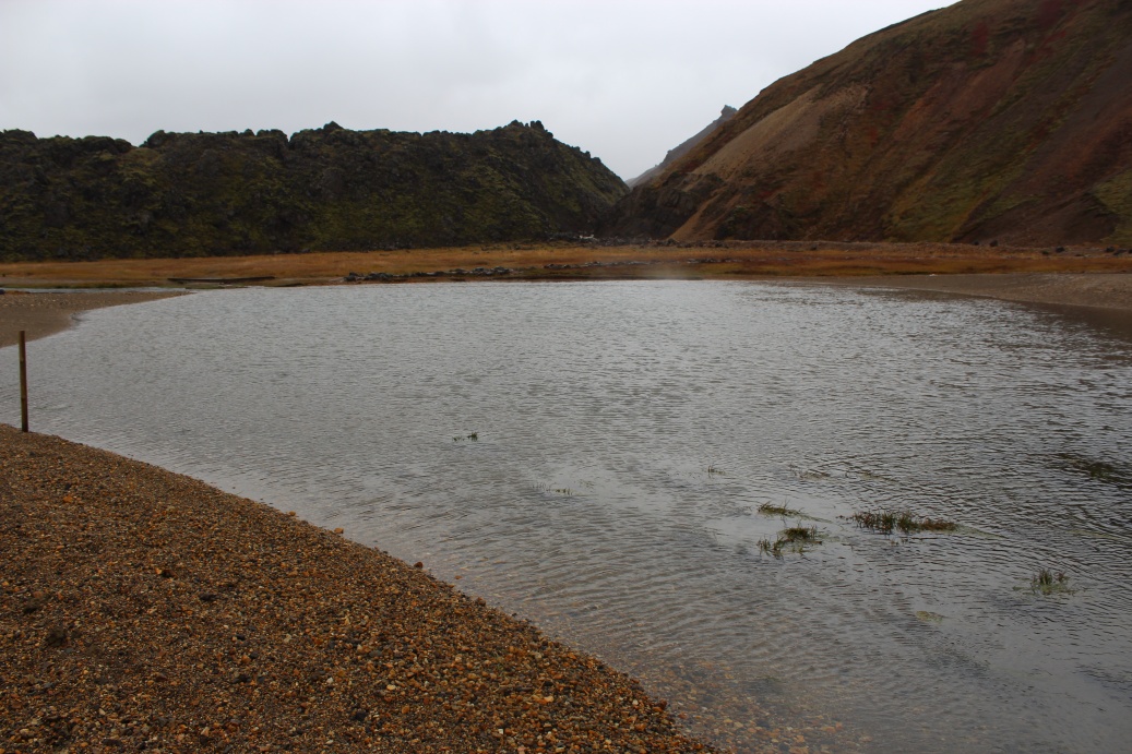
Landmannalaugar - hot springs - 'trapped' for 2 nights by heavy rain swelling the rivers, fording may be 'possible' but not advised by rangers.
After having to rush pack-up when the tent pegs started pulling out of the ground, that had turned into a marsh, I made for the shelters - so windy that they were next to useless. I was then joined by Fred and Allegra and we 'commandeered' the washroom. Their tent was leaking badly and nearly all they had was soaked! There were only two other couples there, both were renting space in the cabin.
We cooked, ate and chatted for a day whilst the rain poured down. The river fords at the entrance to the site had risen about 30cm. Possibly passable but very risky. I talked to the ranger and she said "this is the worst weather for the end of September in a long time!", and advised not to try and ford the rivers. Several people drove up to the fords in large 4x4's parked and walked in - they did not want to risk the crossing. I was up there for a while chatting to them trying to encourage them to try and get through - I was perhaps being selfish in that if they could get in we could get out, and I was not risking my car to find out. None tried to ford that day - don't blame them the river looked very scary by now. No pics of any of this it was almost tropical storm wind & rain.
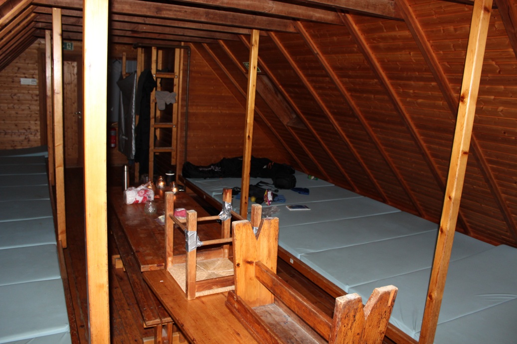
After a day in the washroom, it had heating but not sufficient to dry everything, I rented a space in the hut on site. 4 dormitory rooms - I took the largest as it had more drying space. Fully equipped kitchen with utensils, cutlery, condiments and loads of food left by other travellers.
Jump to: Day 1, Pingvellir Day 2, Geysir Day 3, Hekla Day 4, Landmannalaugar Day 6, Gigjokull glacier Day 7, Hengil / Keflavik
Day 5: Landmannalaugar & Seljalandsfoss
Monday morning and the rain had slowed to occasional drizzle, breakfast in a fully equipped kitchen - porridge, pear and strong coffee! Then out to get some pics, only had an hour or so - we had decided to leave in convoy as we knew there were some significant fords that we had to cross - and the rivers were still all very swollen. I had managed to dry almost everything and was feeling much more comfortable - lets see how long that lasts! My phone was running low by now - I had it, my GPS or laptop on charge whilst driving, but being stranded here I had no chance to recharge it and it was using its battery fast - long way to nearest cell phone tower! So phone off most of the time - got to keep sufficient charge for emergencies.
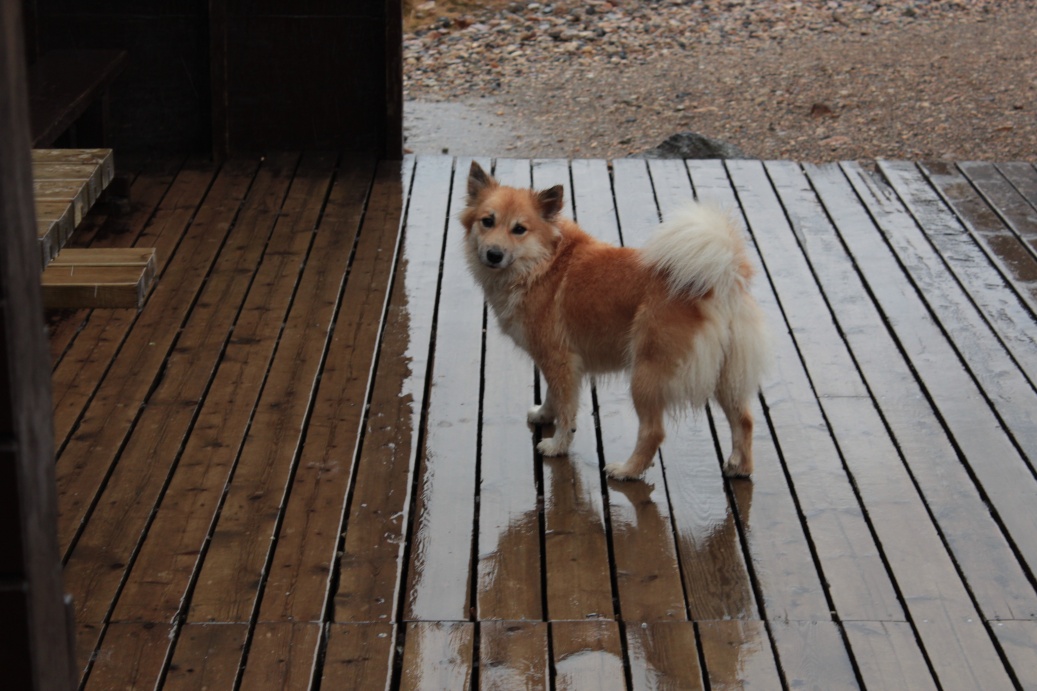
The rangers Icelandic sheepdog - its tiny and very fox like. The 'sheltered' outdoor cooking areas were awash!
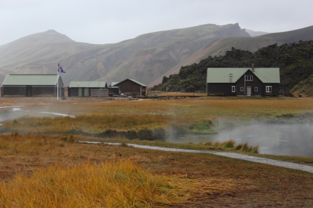
The huts at Landmannalaugar - dormitory hut is on right, washroom on left - hell of a run in the storms as no wash/shower/loo facilities in the dormitory hut! Ranger hut in centre and open cooking area in front of the small building with 2 green doors (a storage building - gas cylinders, snowmobile etc.) Only electrical power was from a small diesel generator hidden at the edge of campsite by a rough wall/pile of boulders, and only available to the rangers.

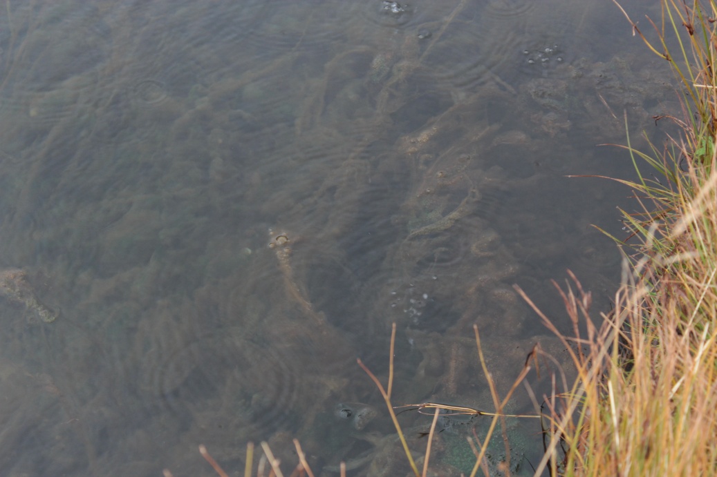
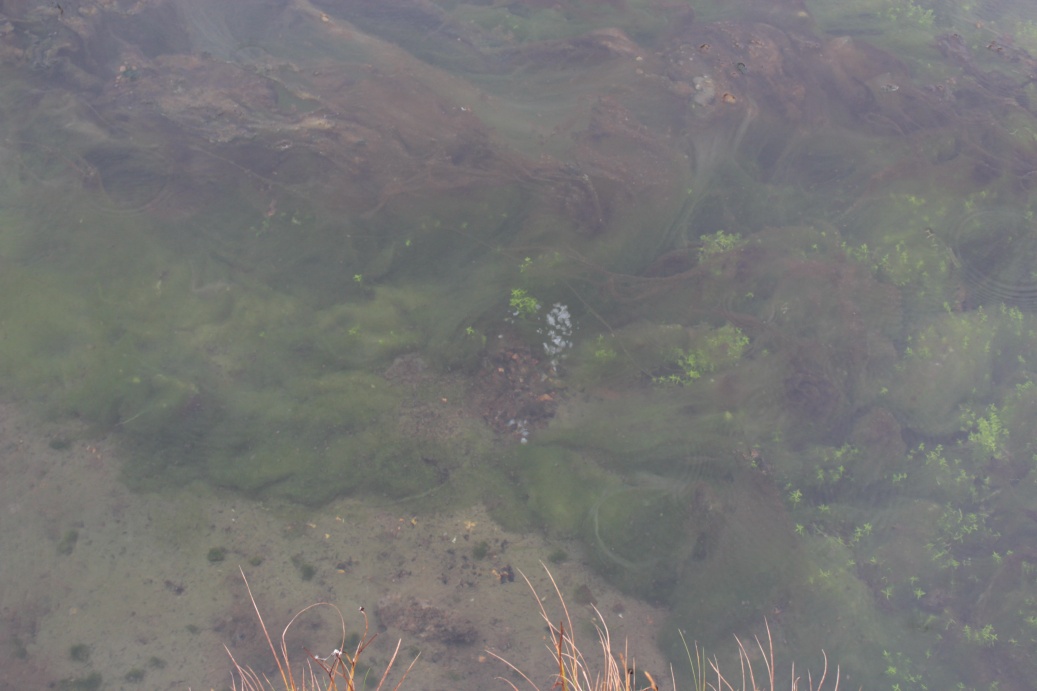
These hot pools were full of the most amazing bacterial mats. Only had a paddle in the pools - the water was really hot - too hot. There were also a lot of very prominent signs describing a parasite problem in the pools. 'Nerve' eating mussel (bivalve) parasites that have caused several cases of paralysis in the last few years, and many cases of asthma. Dip at your own risk!
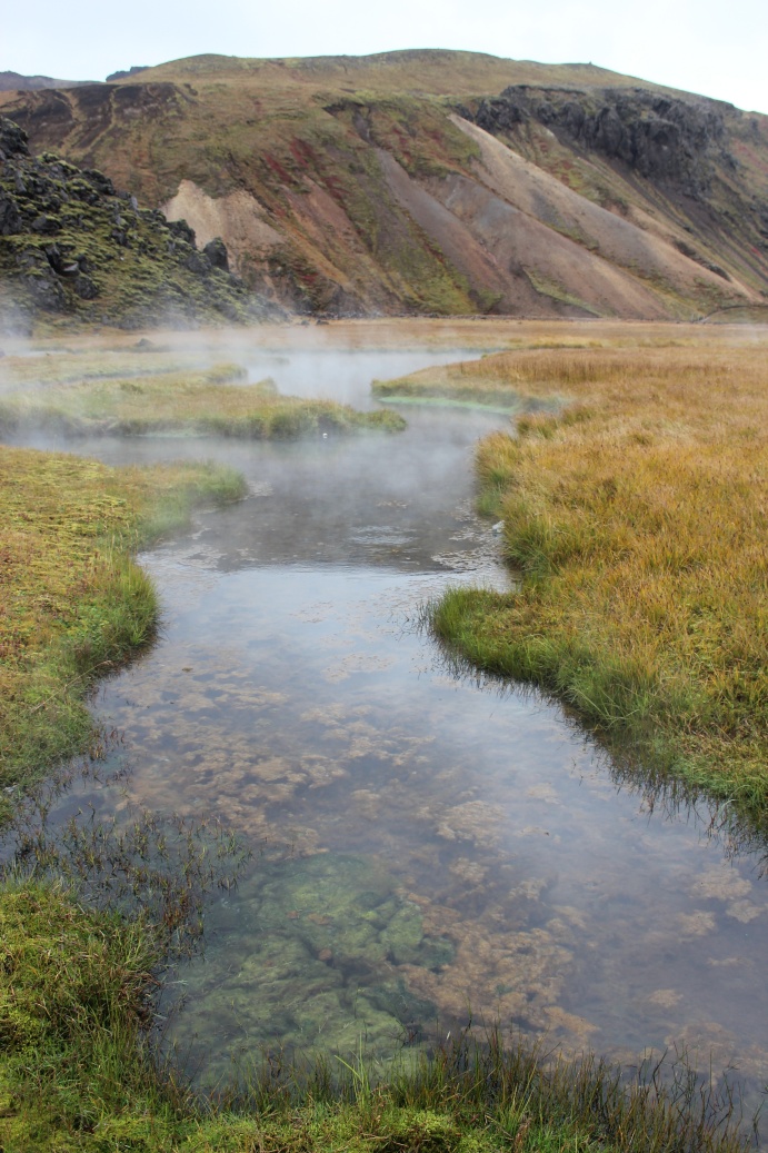
The water was literally boiling in places!
The first of 2 fords we have to cross to get out - hmm!! A last walk into the gorge for a peek!
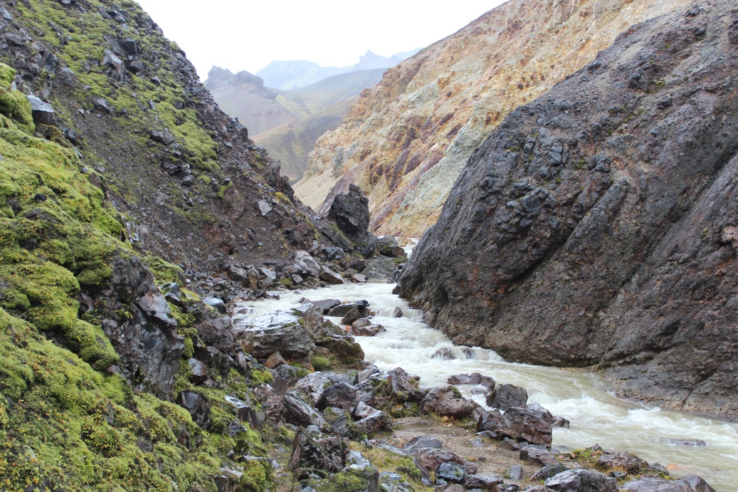
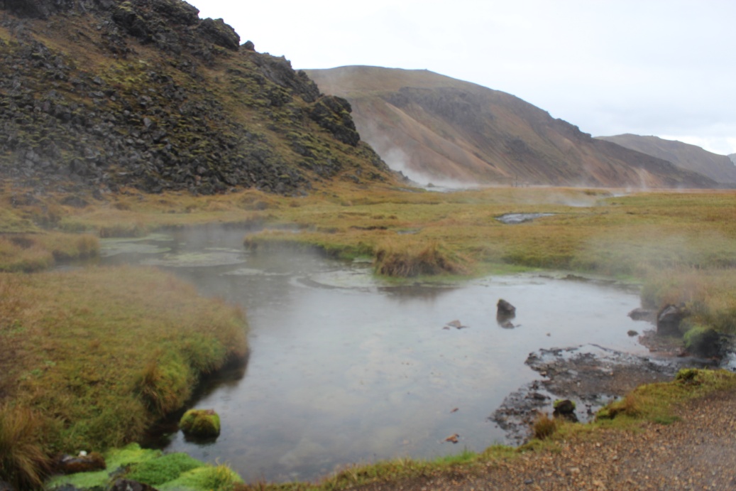
The river was wild in the gorge - more crazy colour schemes - I made my way as far as the big rock centre image about 250 metres through the gorge.
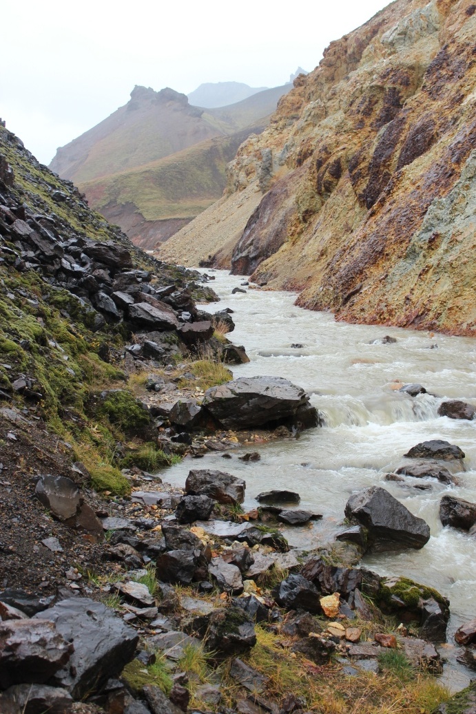
If only the sun was out - these colours would really pop!
Stop taking pics and get back to the cabins, we need to get out of here before the weather changes again. Across the second ford out of Landmannalaugar - that was deep, a little leakage under the doors of the car. I had prepared and put all up in back, just got slightly damp boots. Time for a 80Km 'off road' run to the coast and get cell phone etc recharged - great to be moving again.
Another ford across a 'main' road out of Landmannalaugar, crossed 5 fords on way in, over 20 on way out on the same road!
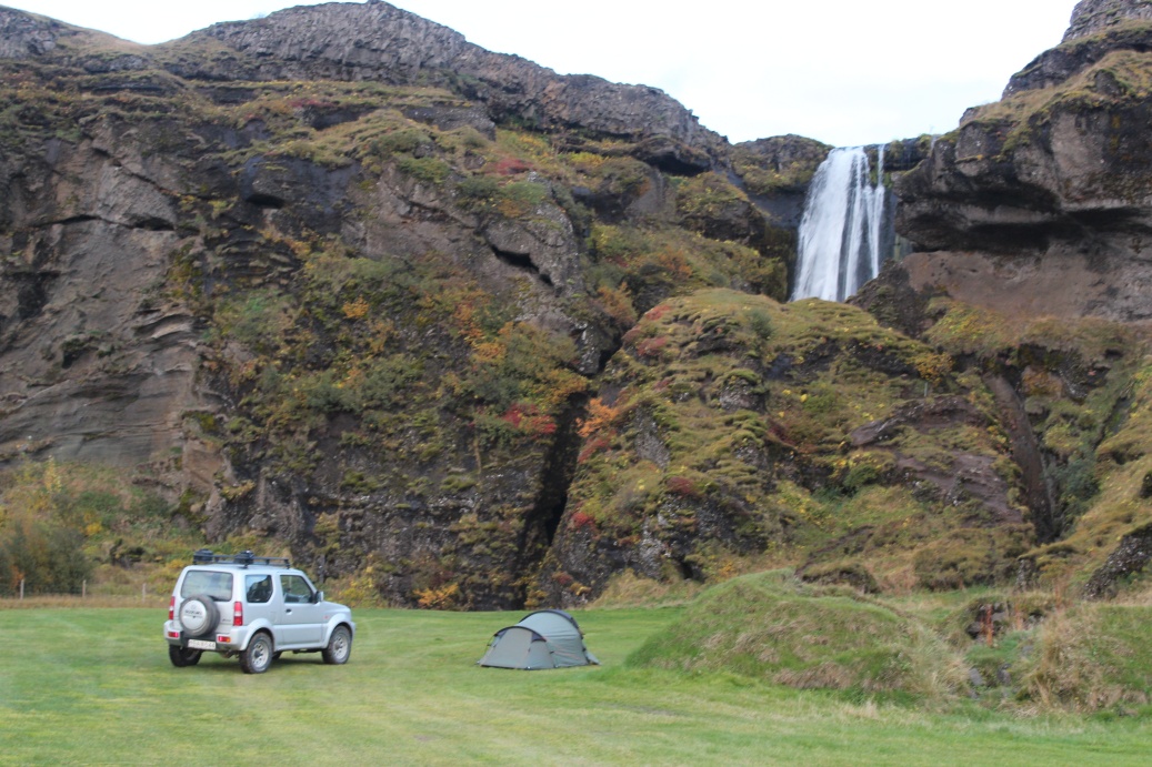
Parted ways with Fred and Allegra at the cafe/shop/petrol station on the N1 / 26 junction - cafe was closed out of season (closed on 15-9). Filled up with fuel, bought more bacon, rolls, orange juice & fruit. Drove onto the waterfalls at Seljalandsfoss. Camped for the night under the falls. This was an excellent campsite. Kitchen, separate shower block, summer visitor centre - closed of course! Site manager came round morning and evening to collect fees etc: 1000ISK - a standard fee it seems.
Late afternoon / evening at Seljalandsfoss
The view off the coast from Seljalandsfoss - the one of the flood deltas for Eyjafjallajokull.
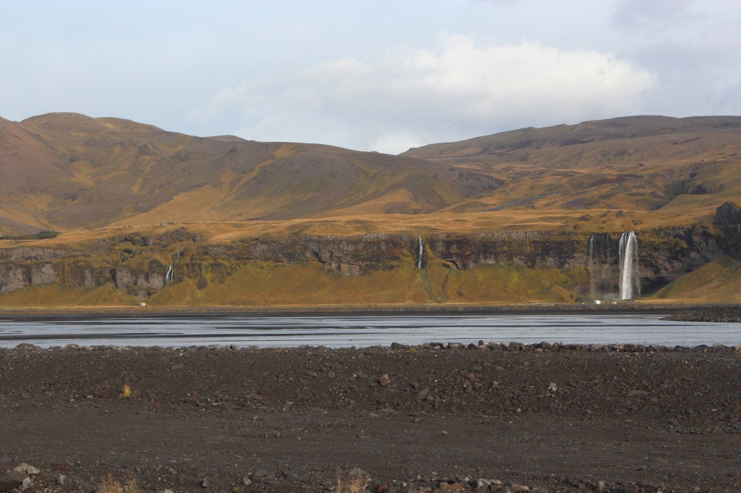
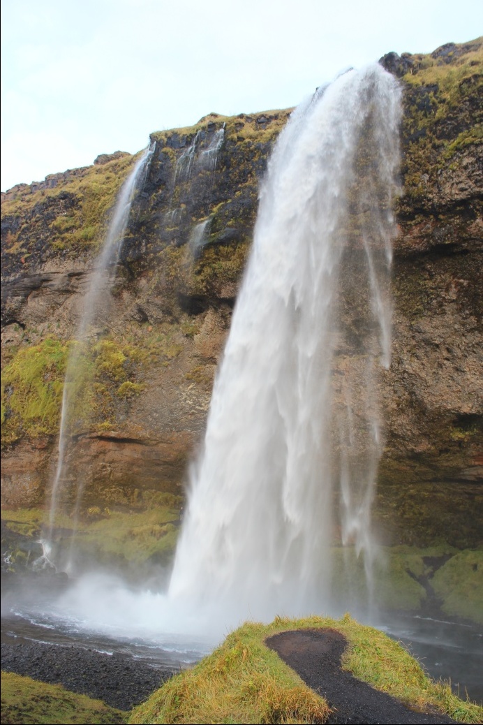
View of the waterfalls from the N1 main ring road - this is a very popular tourist spot.
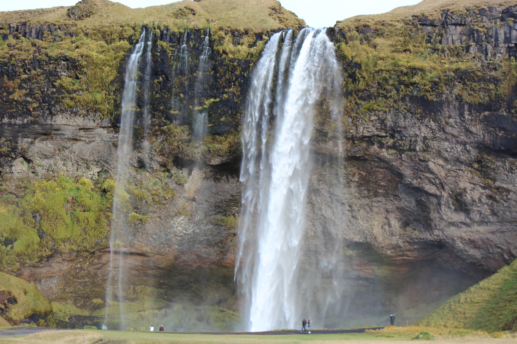
The largest falls here - the spray was reaching out to here!
The smaller falls further up the cliff..
Closer view.
Approaching the side of the main falls - the path behind is slippery wet fine mud on smooth rock rough cut steps.
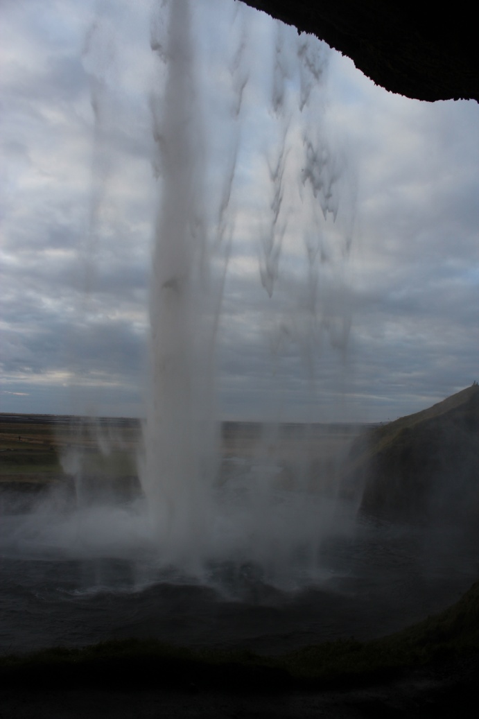
View from the cavity behind the largest of the falls. it was almost foggy with spray - damn, I should have got a rain bag for the camera!
Falls above the campsite - again a fine mist coming out of the canyon!
Light was fading and the skies were clearing again - always hopeful I decided to get some night pic's of the falls - they were illuminated by flood lamps - and wait for the aurora to appear. Had supper of bacon rolls and pasta - again - loads of carbs! Met a German who had spent 4 months touring the island. He was regularly using these 'unmanned' campsites, arriving after dusk and leaving at dawn - he used all the facilities but hardly ever paid - I'm not impressed! Finished eating and went out to the falls.
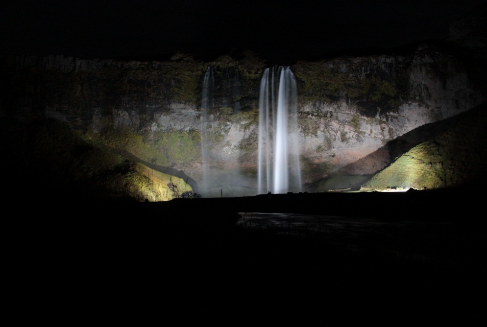
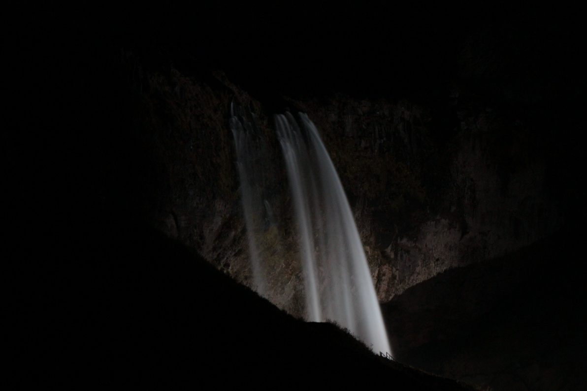
Got these night pics of the falls but the clouds kept rolling in - occasionally giving hope by thinning a bit - but had not cleared by 04.30 so I finally gave up! I heard light drizzle start about dawn.
Jump to: Day 1, Pingvellir Day 2, Geysir Day 3, Hekla Day 4, Landmannalaugar Day 5, Landmannalaugar & Seljalandsfoss Day 7, Hengil / Keflavik
Day 6: Gigjøkull glacier
Camping at bottom of falls. The drizzle had stopped and it was rapidly brightening. Breakfast of a huge bowl of porridge and cups of strong coffee. The German had left well before 09.30 - when I got up. I was surprised that everything was starting to get damp again then realised it was the car, all the 'fabrics' were damp and storing all in the car overnight caused it to pick up the moisture - I had spent every day battling condensation on the car windows so I should not have been surprised! Not such a problem today it was getting sunny and that would help dry the car, I just hope the sun lasts - its becoming a lovely day! I decided to try and get to the Gigjøkull glacier about 25Km up the F249 - on the edge of the Eyjafjallajokull volcano ice cap.
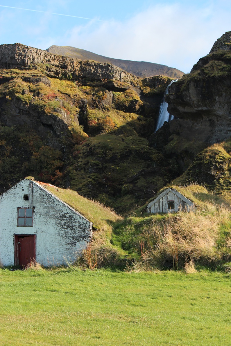
Old 19th century(?) farmhouses.
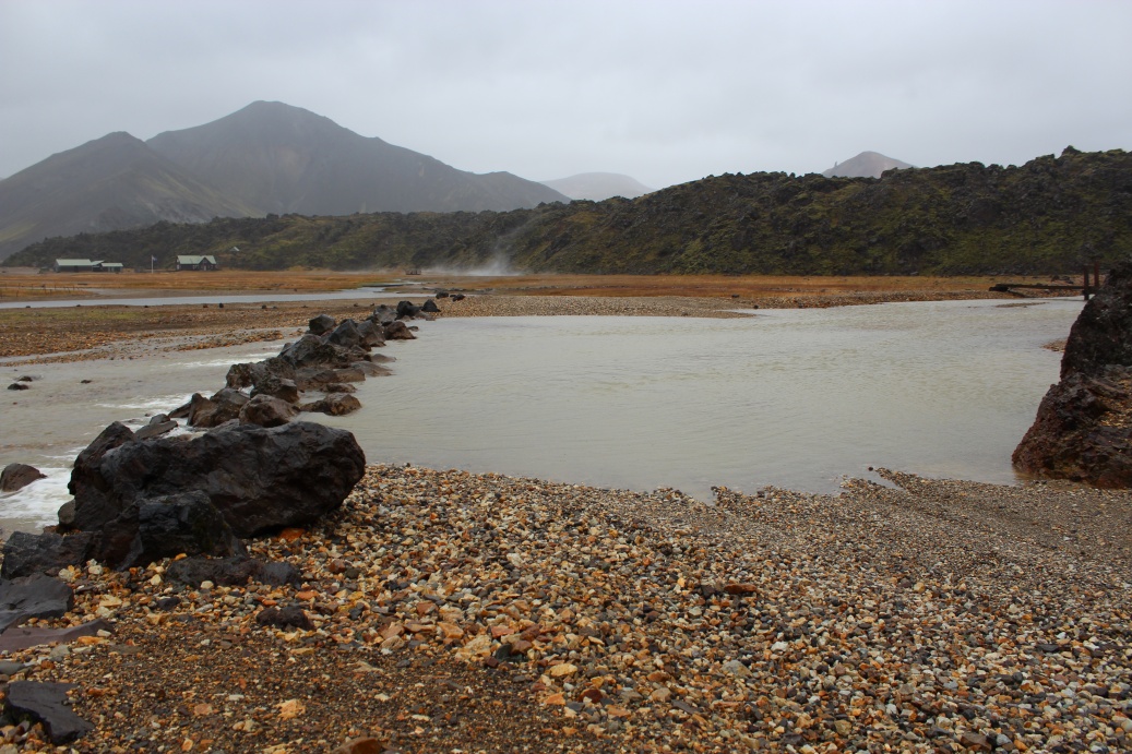
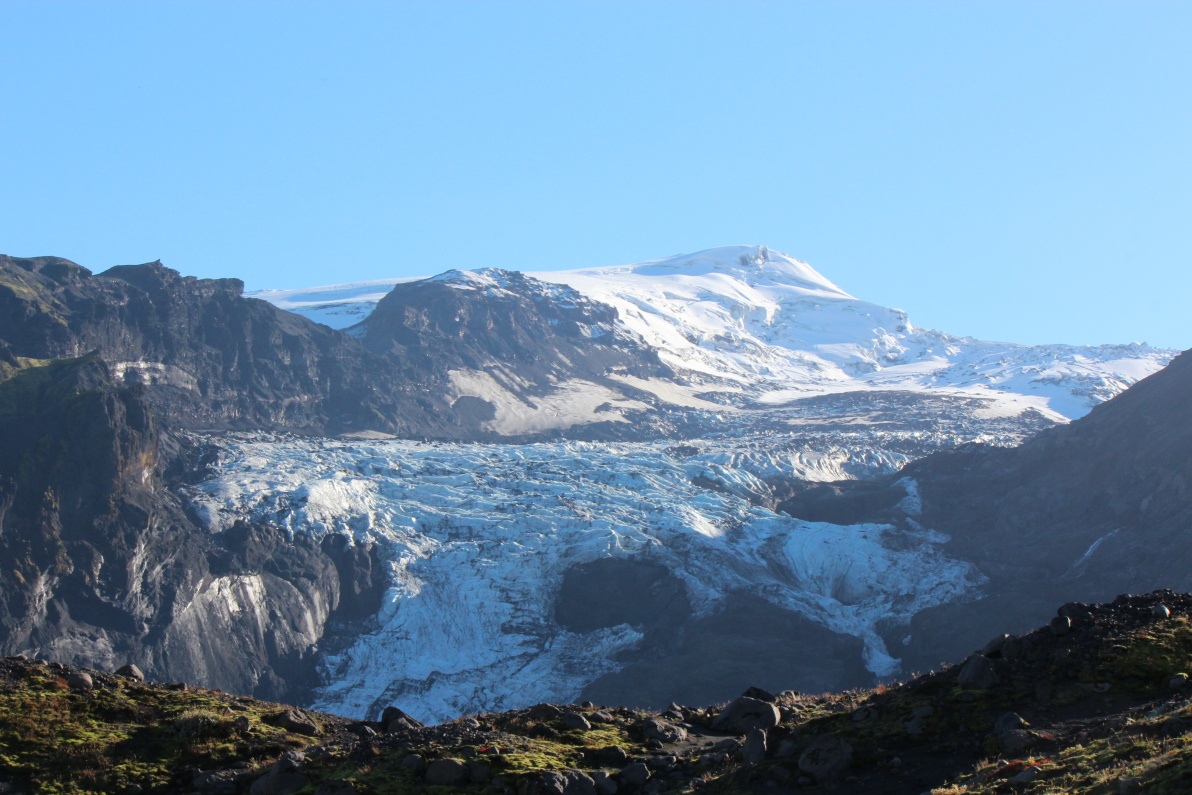
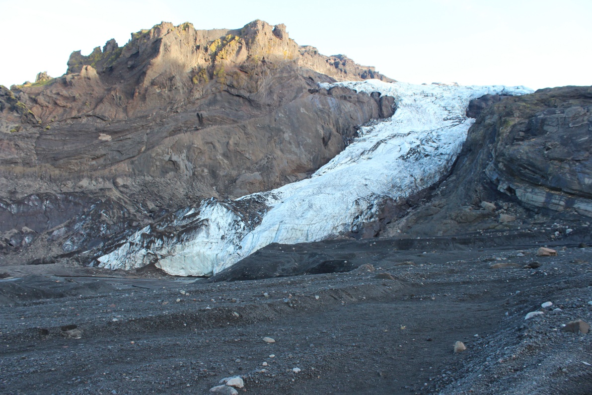
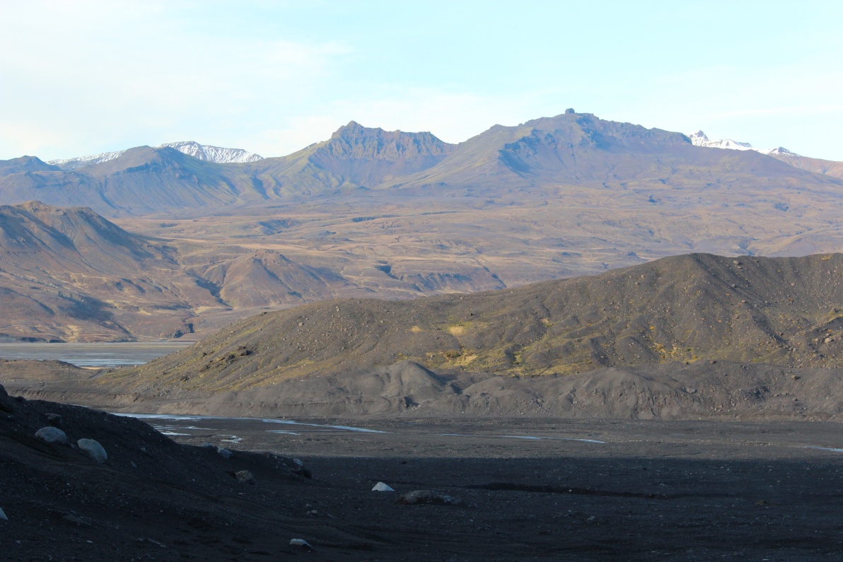
On the road to the Gigjøkull glacier - no idea if the roads go near or I'll have to hike the last few Km. Its a glorious day, no wind bright sun. The glacier had a lake at its base until Eyjafjallajokull erupted. The lake was filled with pumice and ash! This allows direct access to the tongue of the glacier.
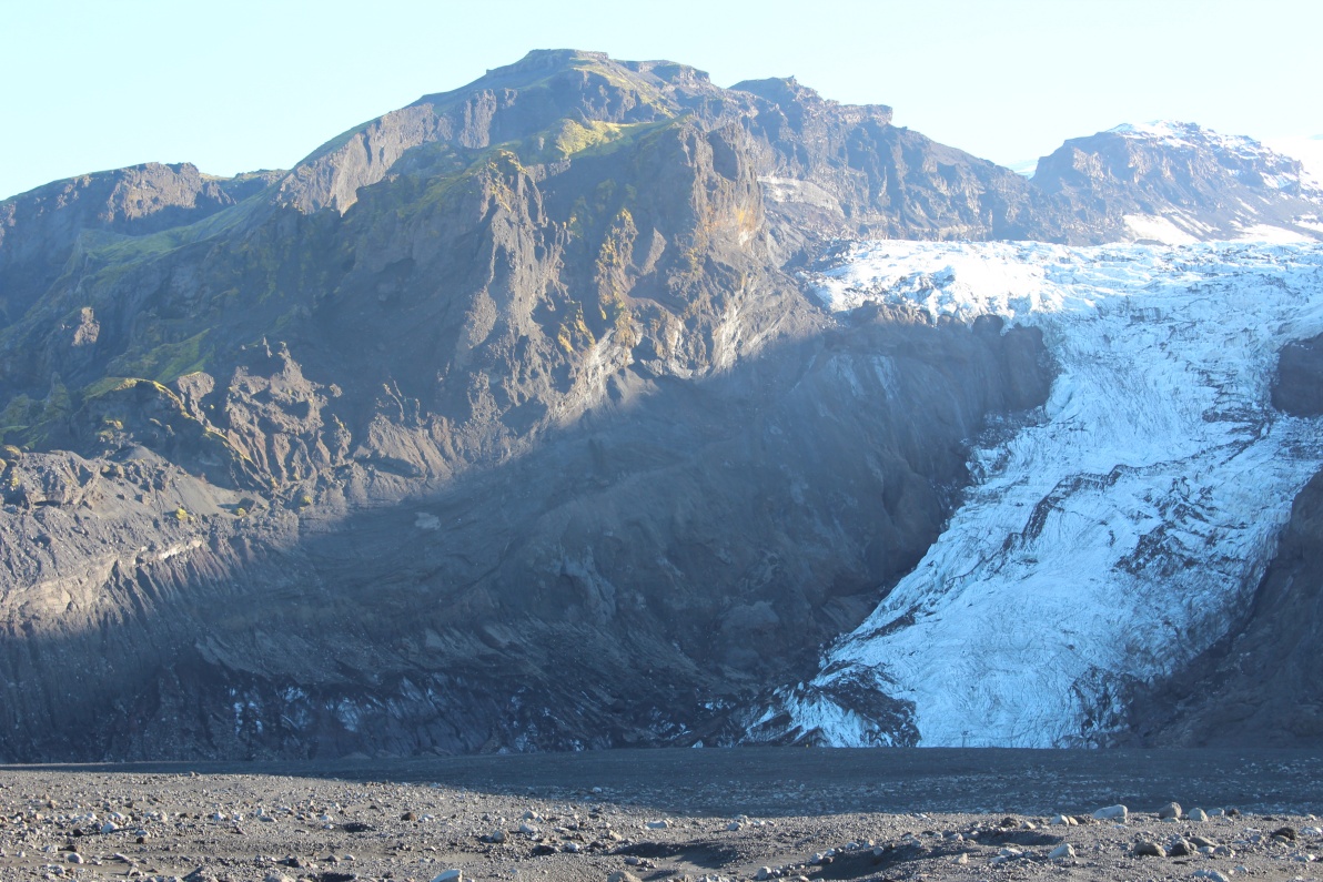
First view of the Eyjafjallajokull icecap, still many Km away. Gigjøkull glacier visible at left.
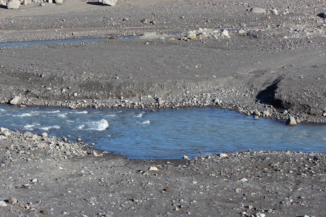
The F249 road, heading in general direction of the Gigjøkull glacier, had deep ford after only a few hundred metres..
Amazing colours in the views.
This is the 'maintained' part of the F249 road - my speed was limited to 15...25kph - anything faster and those pot holes could really make the car jump - its only a lil' thing. I had already 'bottomed out' the front suspension several times and that is a real jolt to the system!
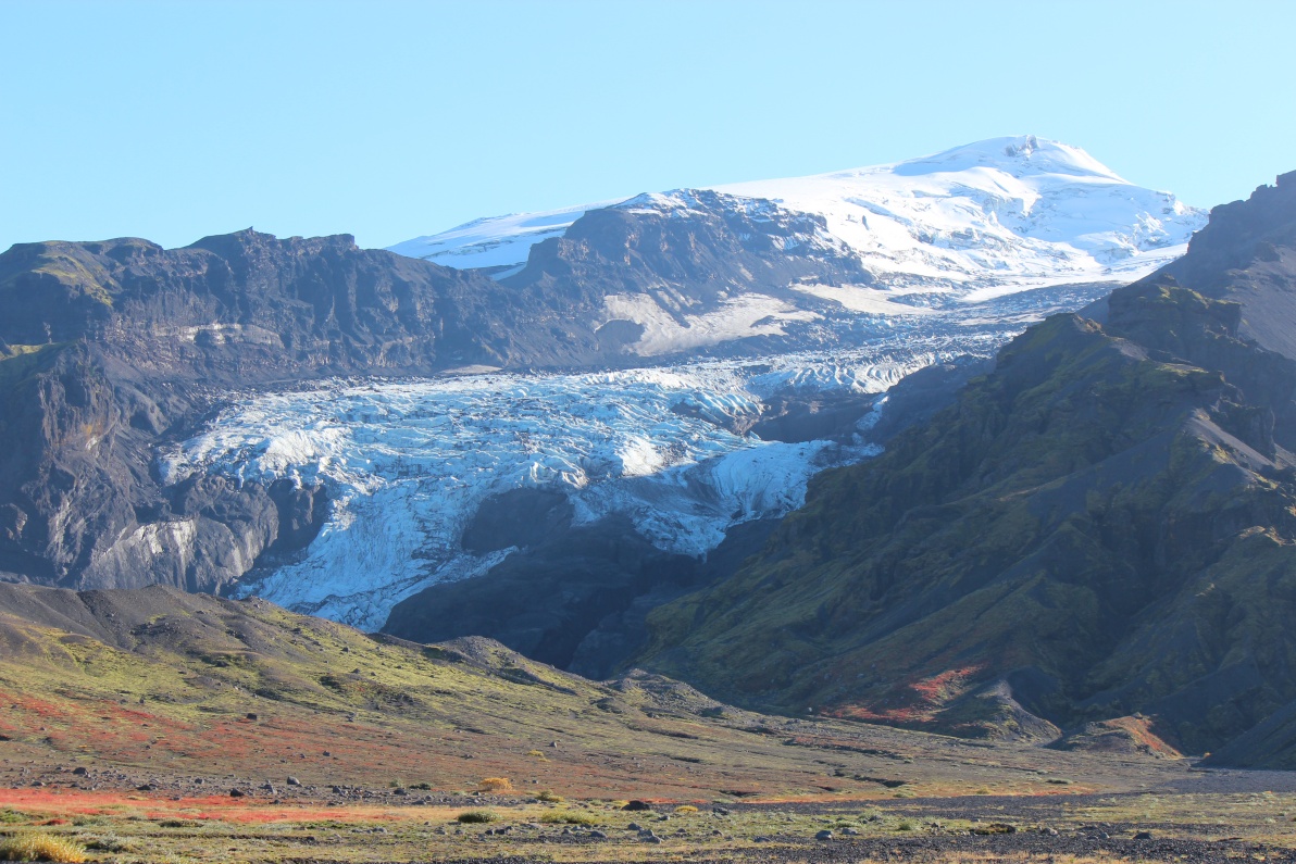
I took a side track off the F249 - its looking closer. Gigjøkull glacier coming off edge of the Eyjafjallajokull volcano icecap. Beautiful weather.
This glacier is looking bigger and bigger!
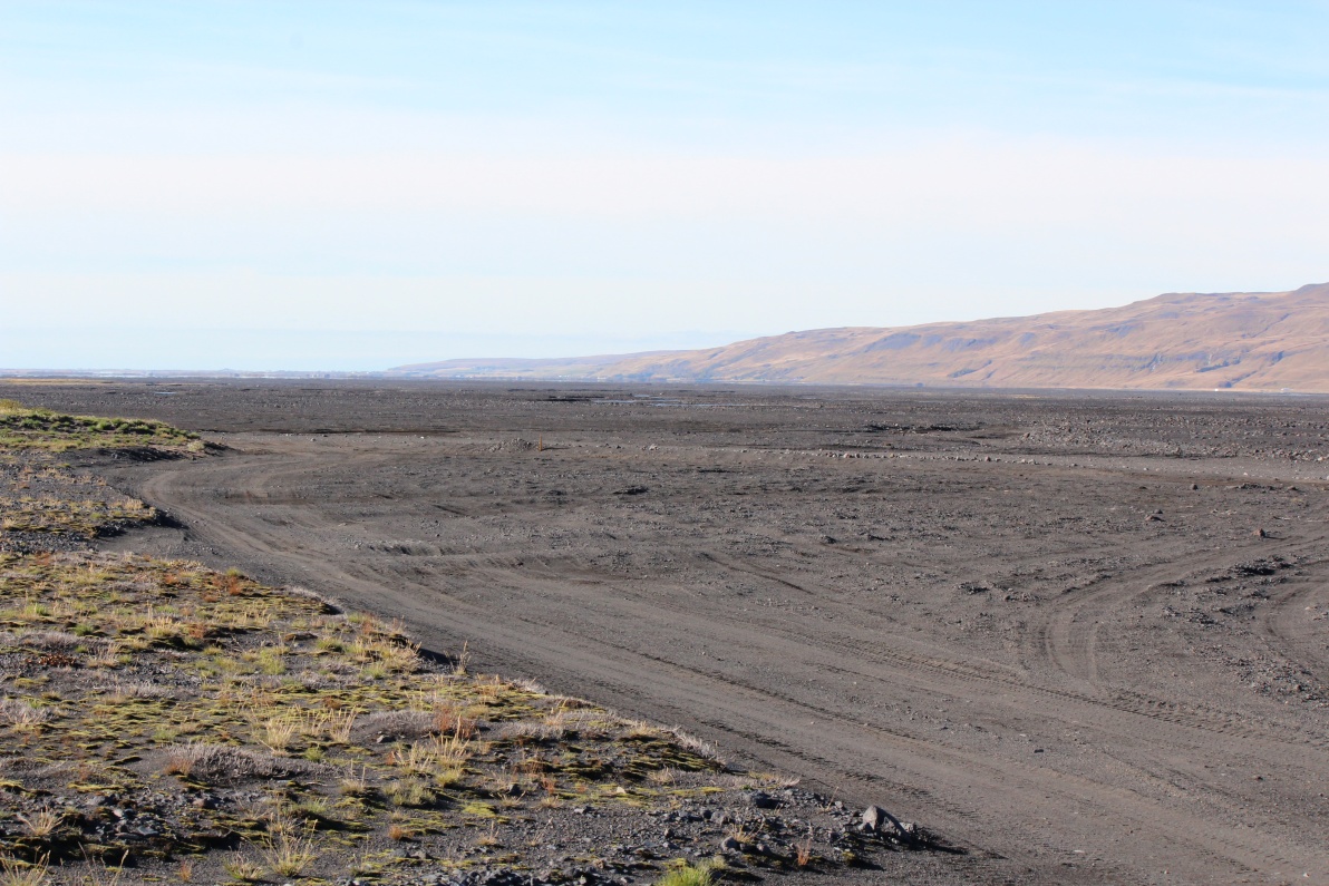
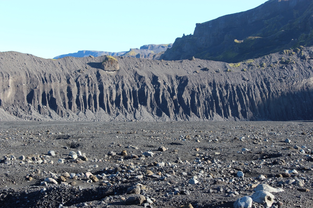
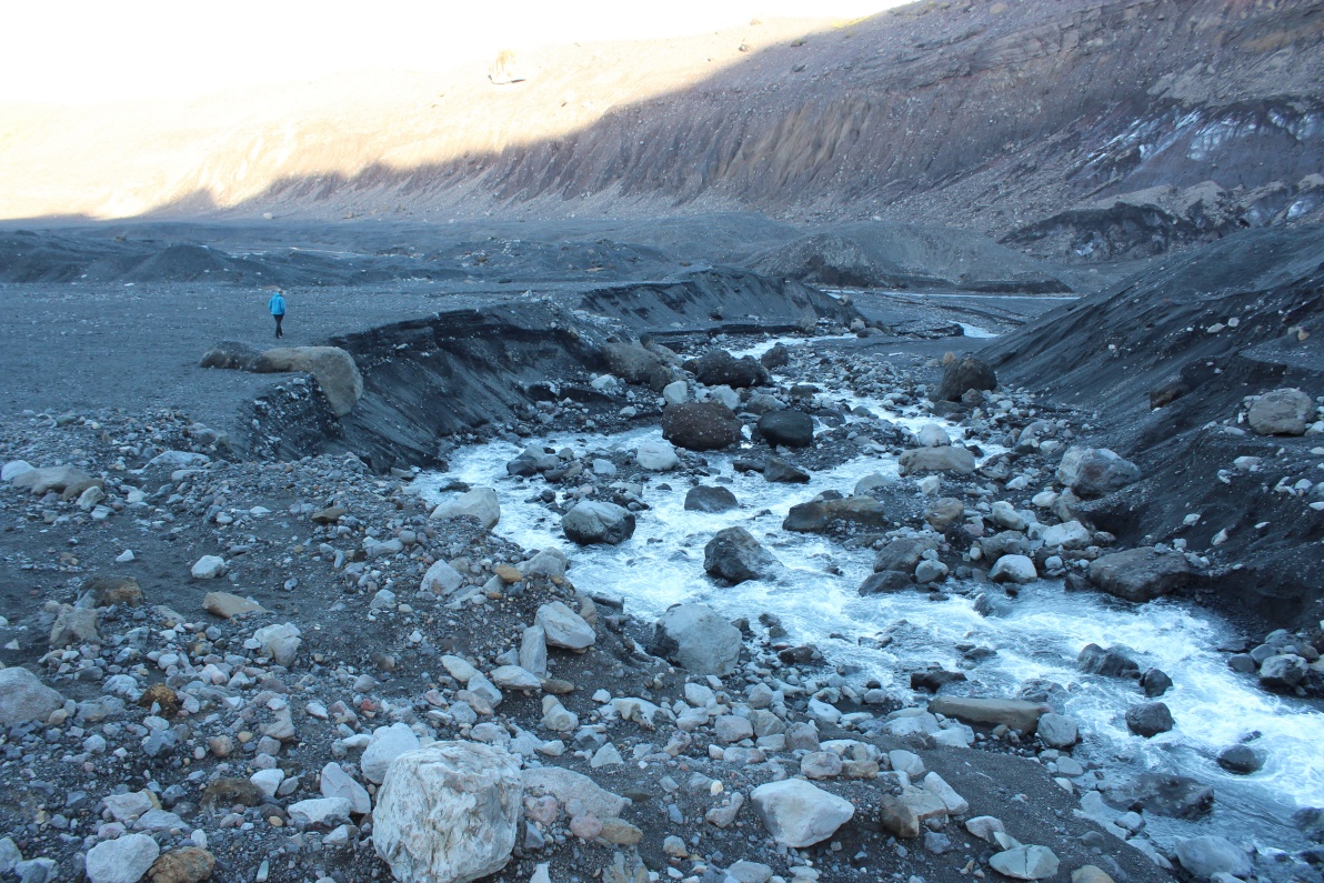
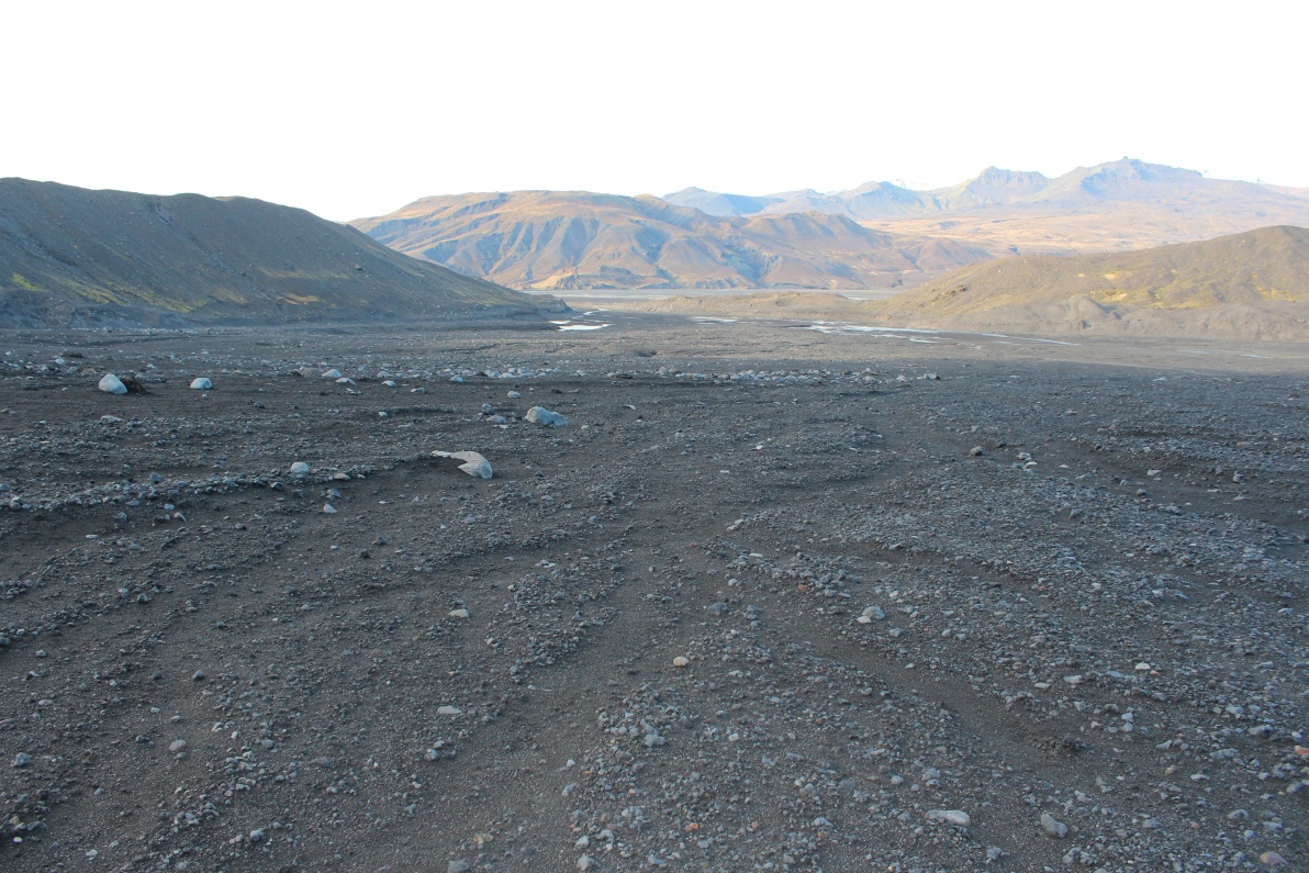
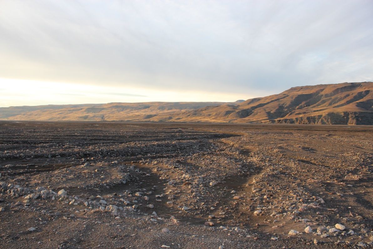
The view back out across the ash delta left by the eruption 2010. The driving is much smoother on the fine ash plain but there are gullies and fords every few hundred metres.
Around this last ridge and I should be in sight of the glacier tongue.
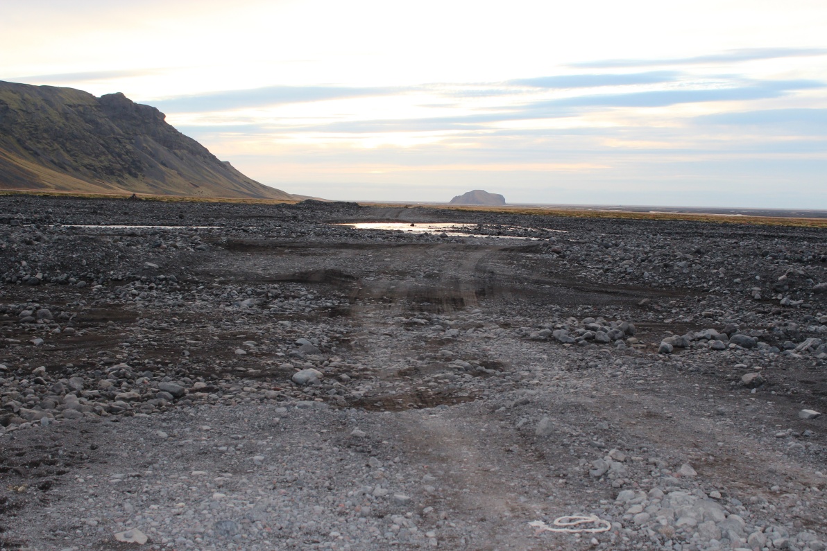
Ahh - that ford looks a bit deep. I checked it out - throwing rocks in - and it looked over 0.6M deep - a bit too much to risk the car, I hadn't seen another soul for hours and did not want to get stranded. Embarrassing if I have to call out the recovery services - and not cheap as it would not be covered even with my extended insurance.
I made my way up the high road parallel with the river, after about 200M it was blocked by a rock fall. The track below is the approach to the ford. The ford was probably passable in the mornings but the days hot sun had significantly swollen the river. It was only about 3Km to the glacier tongue so I packed up my rucksack - food, cooking eqpt, dry(ish) clothes, Fjelduken (survival bag), walking poles etc and set off - I was not going to risk being caught by a sudden weather change - though it was still nice and sunny.

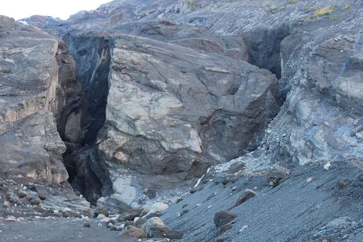
View across the bottom of the rock fall - the track had been completely ripped away!
View back - I must remember where the car is - its around that bend behind the rock fall.
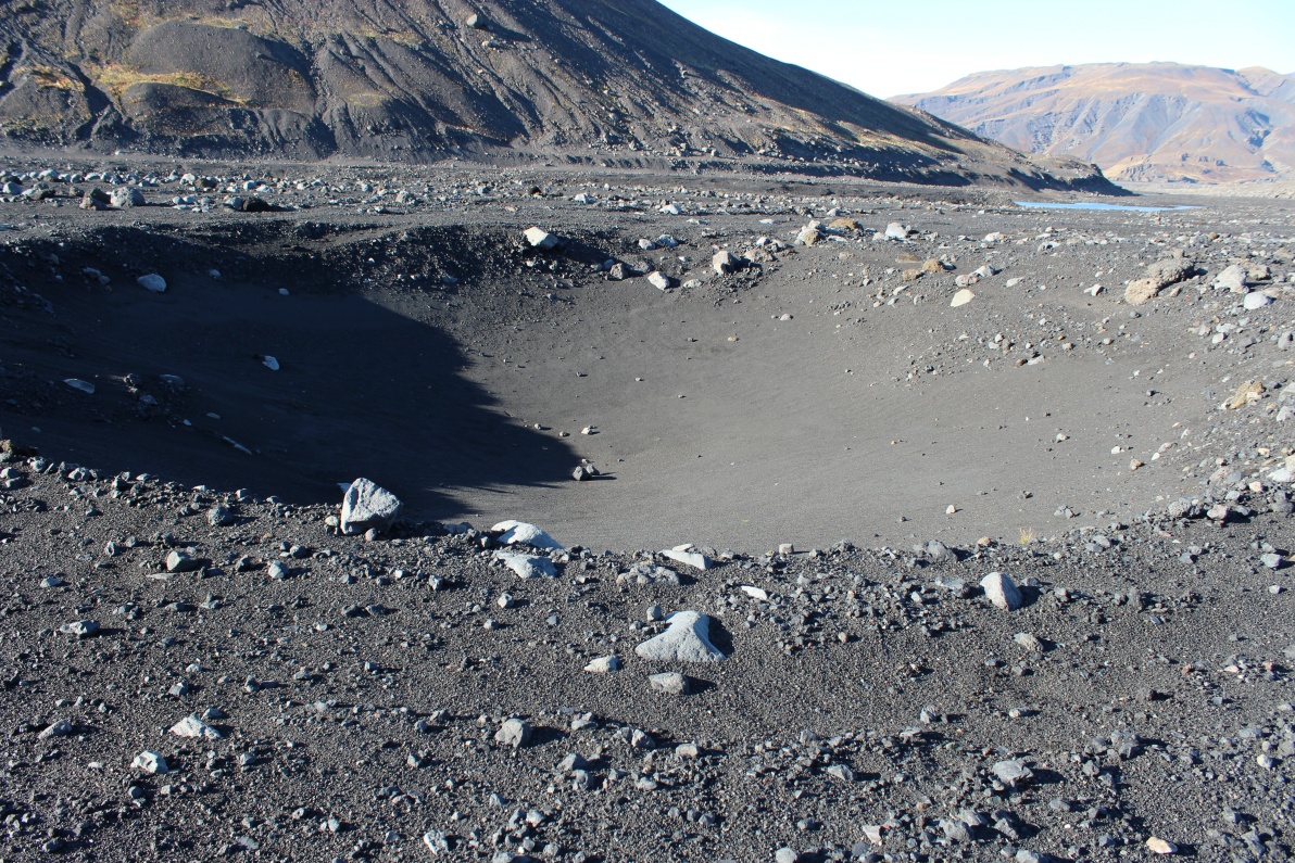
Loads of these 'sink holes' - caused by blocks of ice caught in the ash as it filled the lake. These melted and caused the ash to collapse into these 'craters'. This one is over 15 metres diameter. A helicopter flew down from over the icecap - probably a tourist flight to the top. It slowed and flew very low down over me - maybe 30M up - be nice to think they were looking to see that I was OK.
Huge - building sized - 22M (measured on Google earth) - rock precariously balanced on the outwash canyon wall. Getting used to the scale is difficult - that canyon wall is about 1km away! This whole area was a lake until the last eruption in 2010 filled it all with debris. It has officially been off limits since due to likelihood of quicksand and sink holes! I only remembered this after I had left - I had seen it on TV in the spring! Perhaps that why the helicopter took a close look earlier!
Closer now, but approaching the shadow. Almost getting sunburnt in the sun but the shade is bitterly cold. A strong very cold wind is 'falling' off the glacier (an adiabatic wind as air is cooled near the glacier surface)
In a few more minutes I came across a deep gully with a raging river in it. I packed all my things (camera etc) into 'waterproof' bags inside my rucksack. It was a difficult crossing that I took my time assessing the possible routes across. Even the best options all seemed to need a decent leap at some point. But I'm only here once so it had to be crossed. There are pics of the river on route back.
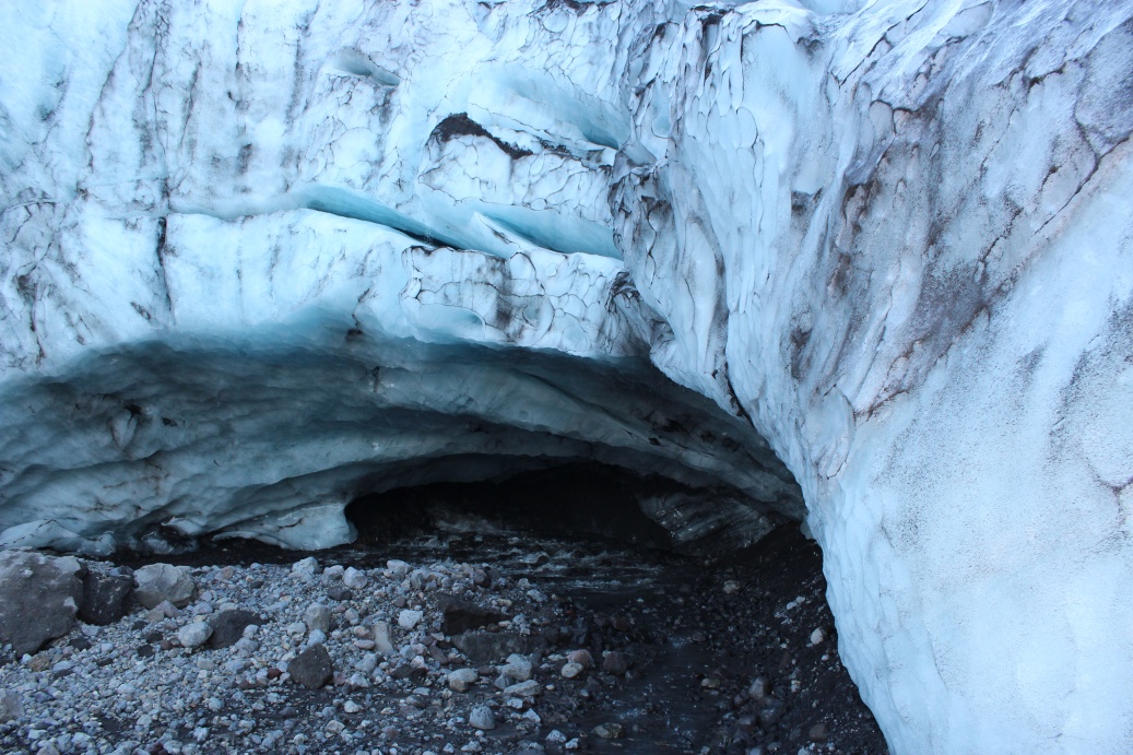
I was stunned - no idea it was here - an ice cave at the bottom of the glacier. This was a real bonus.
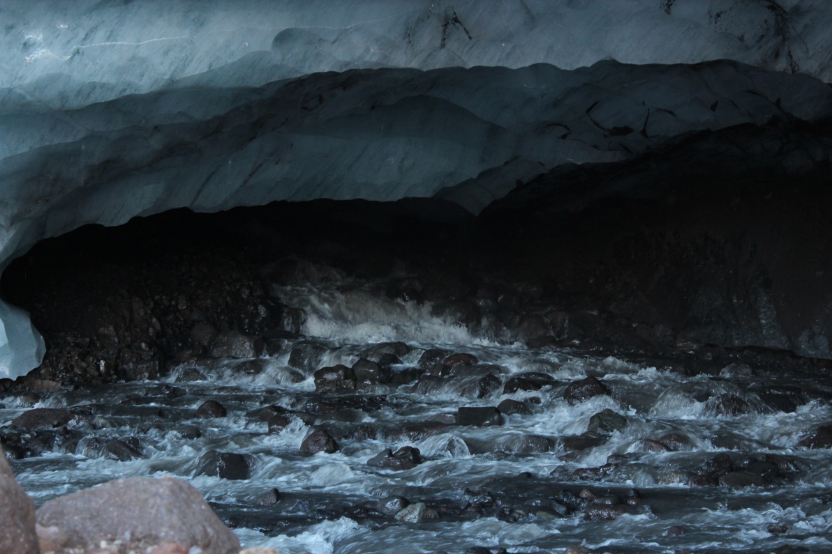
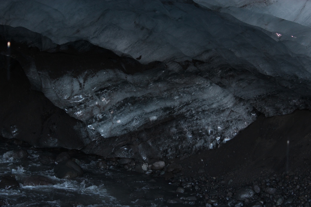
I could hear the rocks occasionally falling, and hear the ice creak. It was 'raining' inside and the river was fast and obviously cold!
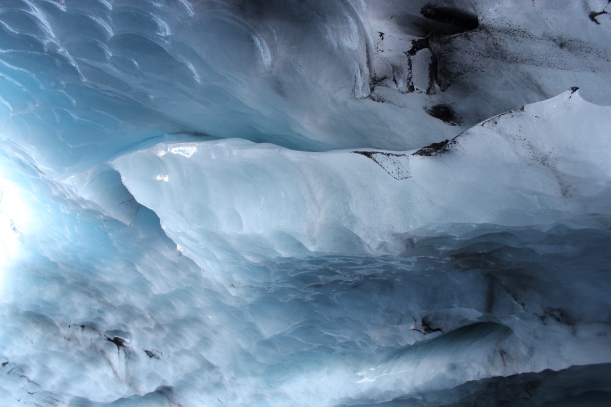
The ice was blue to white and had classic 'thumb print' surface - loads of collected dirt embedded deep in the ice.

The ceiling was constantly raining, I was concerned for falling debris and too many drips on the camera. Drips were going straight down the back of my neck as I 'hunched' over the camera - damn that's cold!
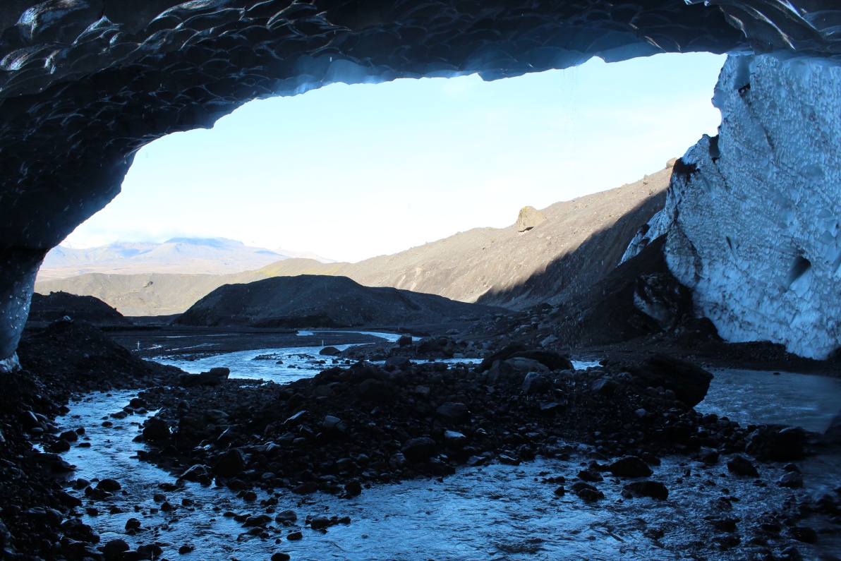
The view out of the ice cave.
The actual base of the glacier - I'm sure it would have measurably moved in the time I was there - the glacier was creaking well!
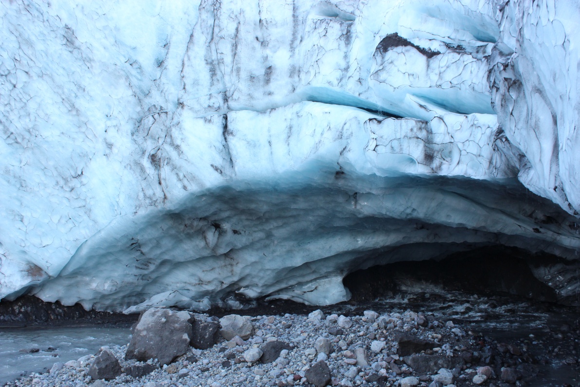
View back into the ice cave - the entrance is about 2.5M high. Just missed a small ice rock falling down the ice face - made a big splash - do not stand around here too long!
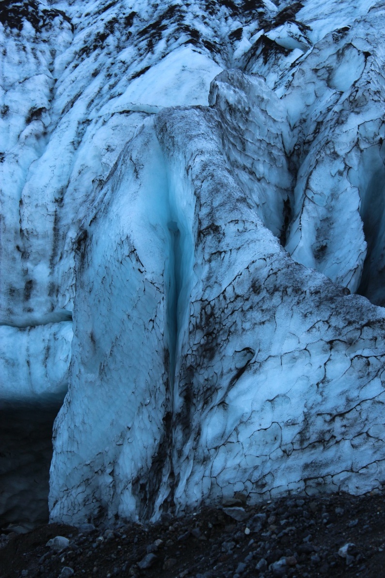
Blue crevice in ice tongue.

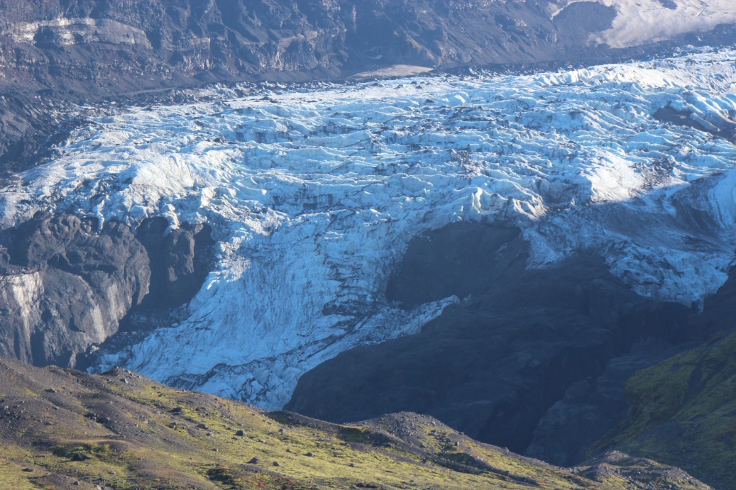
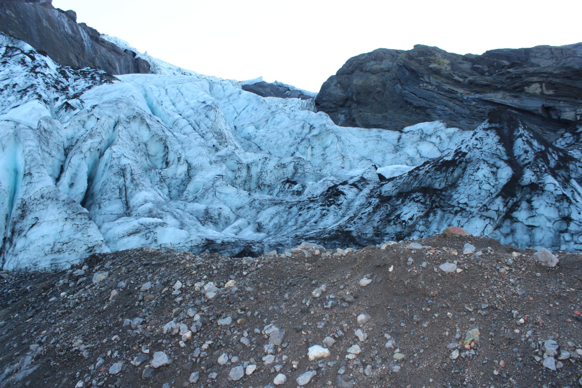
Looking back up the glacier - it is huge!

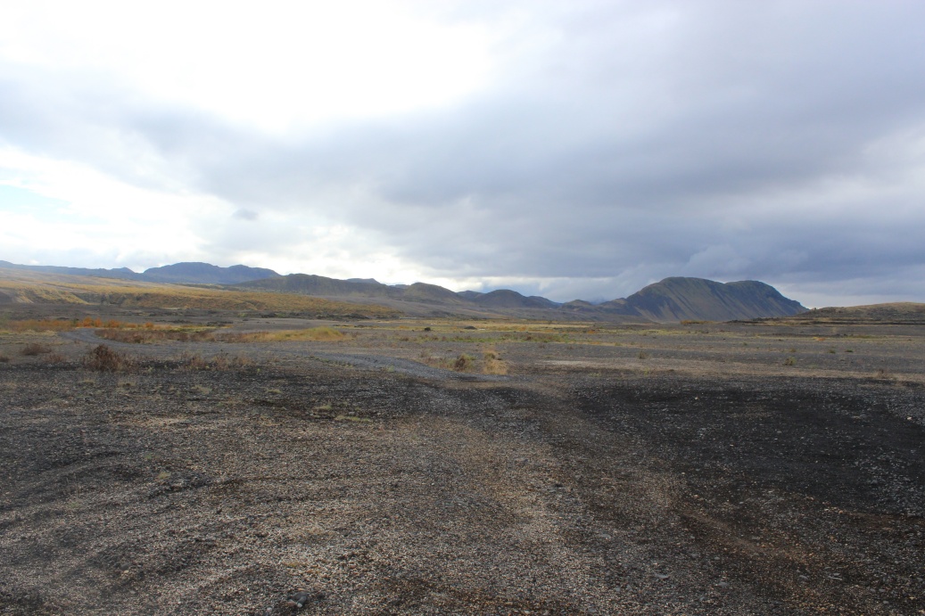
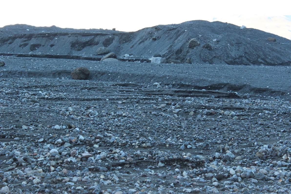
Making my way across the moraines, towards the raging river I had crossed to get to the glacier tongue, a lunar landscape of black ash and pumice.
Amazing view - I had no idea I had climbed this far.
Walking across a 'lunar' lanscape!
The river running from the glacier and a collection of small waterfalls around the head of the valley - this is wild water and barely over 0C. The crossing to get to the ice cave had been very intense and I had packed the camera etc all in waterproof(ish) bags and sealed up the rucksack. That's why no pics of river on the way in! The big rocks on the lower centre right are about 2..2.5M diameter. My 'walking poles' were essential to help me across the river, checking footing, using as 'mini-vaulting' poles etc - I remember from my Scotland trip how slippery wet rocks can be, I slipped in there but cannot afford to fall in this. It's much larger, colder, faster and I'm significantly farther from safety! Crossing was probably pushing the limits of common sense well beyond breaking, but this had been my one chance, now to cross back!
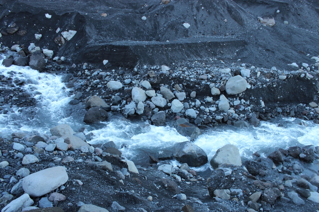
I crossed back over this torrent using the large rocks just left of centre shot. The gaps don't look that large but those rocks are 1.5m diameter or so. The big gap is a jump - no stepping over that - walking pole vaulting! Massive sense of achievement & relief when I was back on the other bank.

One of the many small waterfalls filling the river across the path to the glacier tongue.
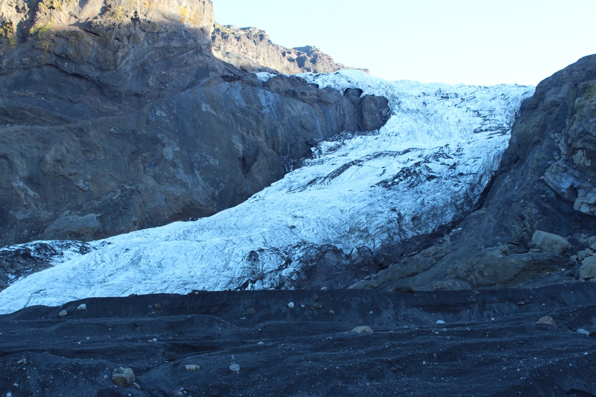
Last 'close up' view of the Gigjøkull glacier.
Back on the safe side of the river I briefly met a German tourist. He had parked his car a little further away then me, and walked up to the glacier with just a camera, no other kit at all! Not surprisingly he would not cross the river. He is in this pic' for scale - that is a wild river! I crossed over the river towards the glacier just about where that large black rock sits in the centre of the little island (top right of centre image). I had decided to come further upstream to get out.
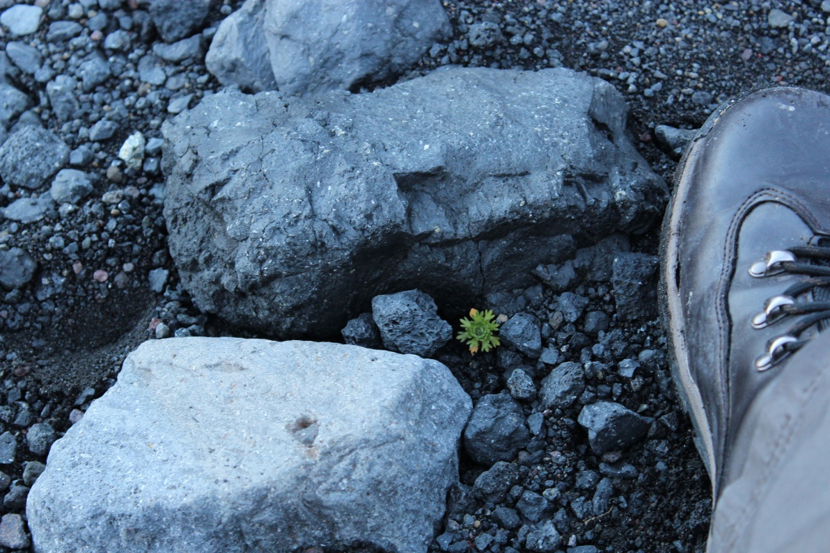
Not many higher plants around here - mostly mosses and lichens - but I found this lil' beasty hiding behind a rock away from the constant cold wind off the icecap/glacier. Boot for scale.
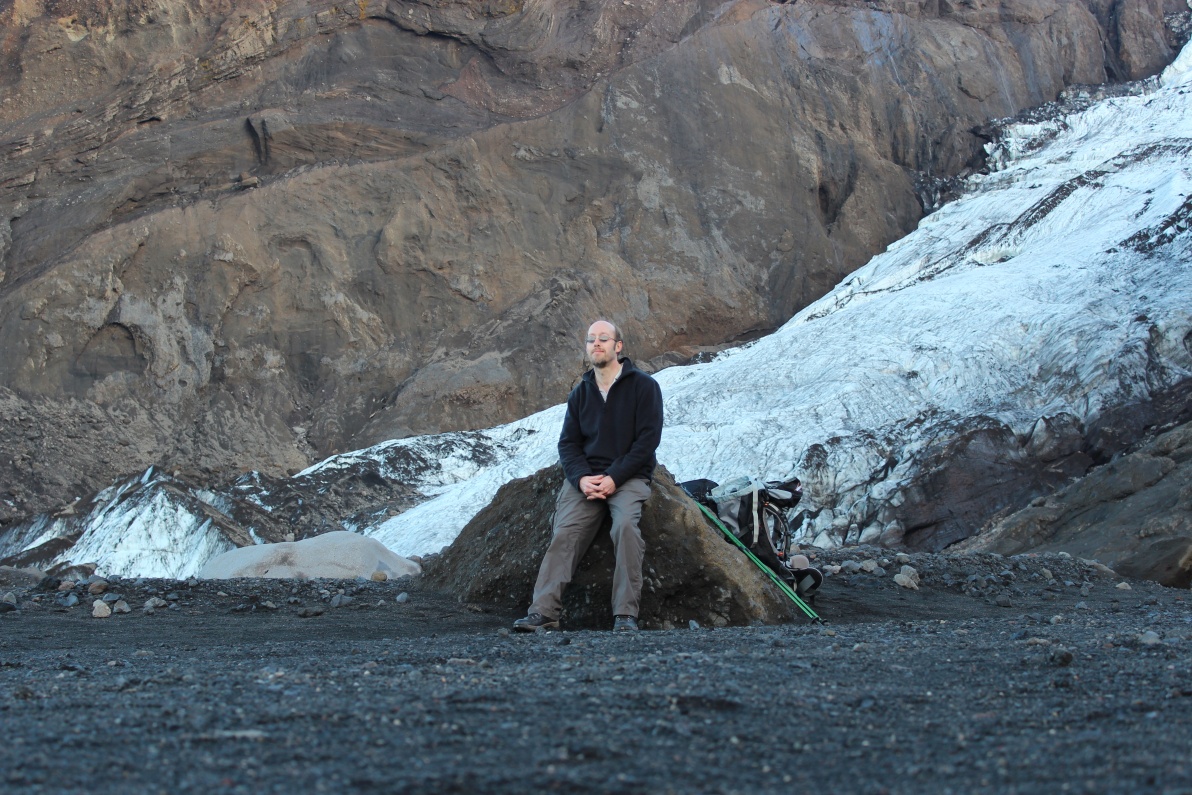
Yes, I really was there - there are only a couple of pic's of me in this gallery - I don't like having my pic' taken! At this time I was feeling quite content and a lil bit smug. It was still very cold in the adiabatic wind but the sun was still shining - an excellent day all round!
Trek back to the car now - its all the way down and just around the rock peninsular bottom left - about another 2 Km. I'll soon be in the sun again. No idea I had climbed up this far, over 200 metres climb according to my GPS.
Climbed up the side of the valley to get another shot of the glacier - the ice cave is visible - and looks really wide from here!
Huge gorge - over 10M wide - next to the glacier - looks like the whole block centre shot has separated from the rest of the surrounding rock on the left and right - an effect of the eruption 2010?
This is an amazing, if rugged landscape! I'd love to stay longer but time is passing fast and I have to get back to the coast and set up camp.
Walking on the Moon, heading for Mars, back to the car.
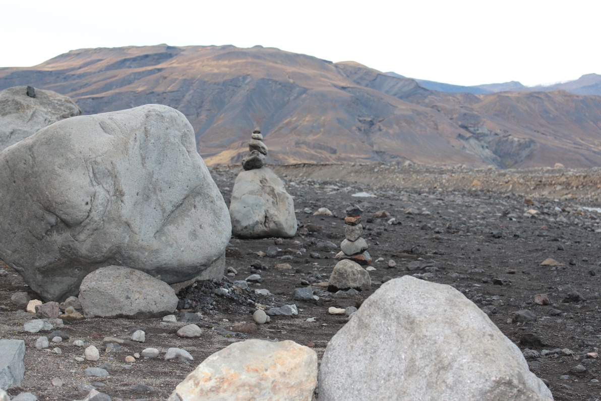
Back to the car - I set up a couple of cairns where I had stopped. Made myself a coffee with glacial melt water from the stream below and absorbed the experience.
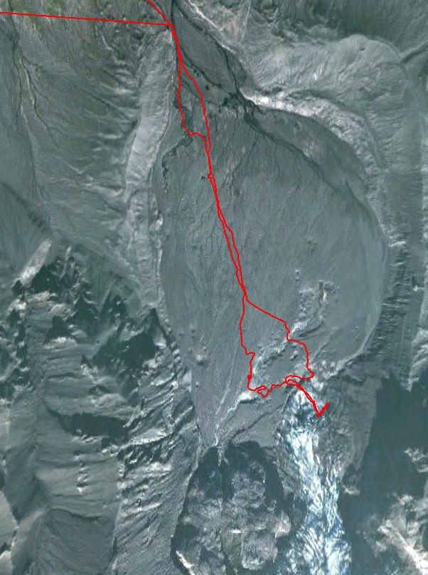
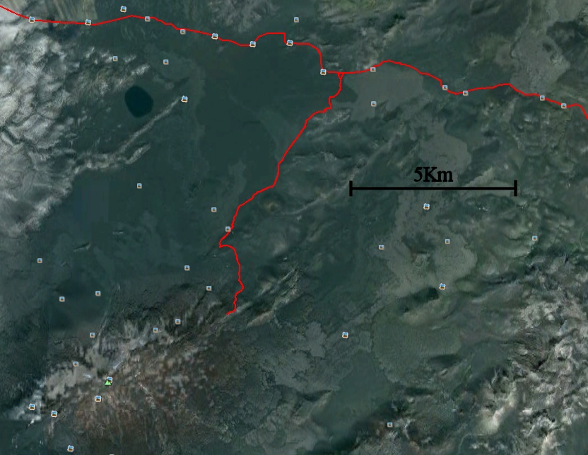
An image of the route I took to Gigjøkull glacier - walked from the top of image - I had GPS failure on way in - very bumpy road - so that straight line is artificial - the road was all over the place up and down the edge of the ash delta.! Stopped car where straight lines converge. Walked about 2.5km to tongue of the glacier. In this Google earth image the rivers disappear into the ash lake - must have been taken just after the 2010 eruption. The rivers have cut decent channels into the ash now and could not be easily crossed anywhere! My GPS tracker had my position relatively accurate to Google Earth, the glacier has receded since this image, the 'dogleg' at the end of the route shows the limit of the glacier - 26-9-2012.
Driving back - endless waterfalls.
Now I am driving across Mars back to Seljalandsfoss!
This landscape is just a riot of colours and textures.
The track back to Seljalandsfoss - its a long 15...20km to the 'made' road! Average speed was probably below 15Kph, and I kept stopping for the views!
One last deep ford and back to the coast. I decided to camp at the same site as last night at Seljalandsfoss as it was close. The day had shot by - it was nearing 19.00 and its dusk by 19.30. The skies had been clear all day - beautifully sunny - but as soon as dusk fell the clouds rolled in again and there was total cloud cover - I think I'll have to come back if I want to see the aurora from here!
Arrived back at the campsite at Seljalandsfoss and 2 Americans were setting up their tent - Mike and his wife (her name immediately slipped my mind!). They were on a 2 week tour around the island - I think more of a rush around as driving 200...400Km per day. Their car had died - battery failure - whilst at the campsite. Not a good thing if planning to go into the interior - glad my lil car seemed fine. Quiet evening, thin clouds, no chance of clearing, little drizzle overnight again! Used up last of dry food and bacon.
Jump to: Day 1, Pingvellir Day 2, Geysir Day 3, Hekla Day 4, Landmannalaugar Day 5, Landmannalaugar & Seljalandsfoss Day 6, Gigjokull glacier
Day 7 - Hengil and Keflavik
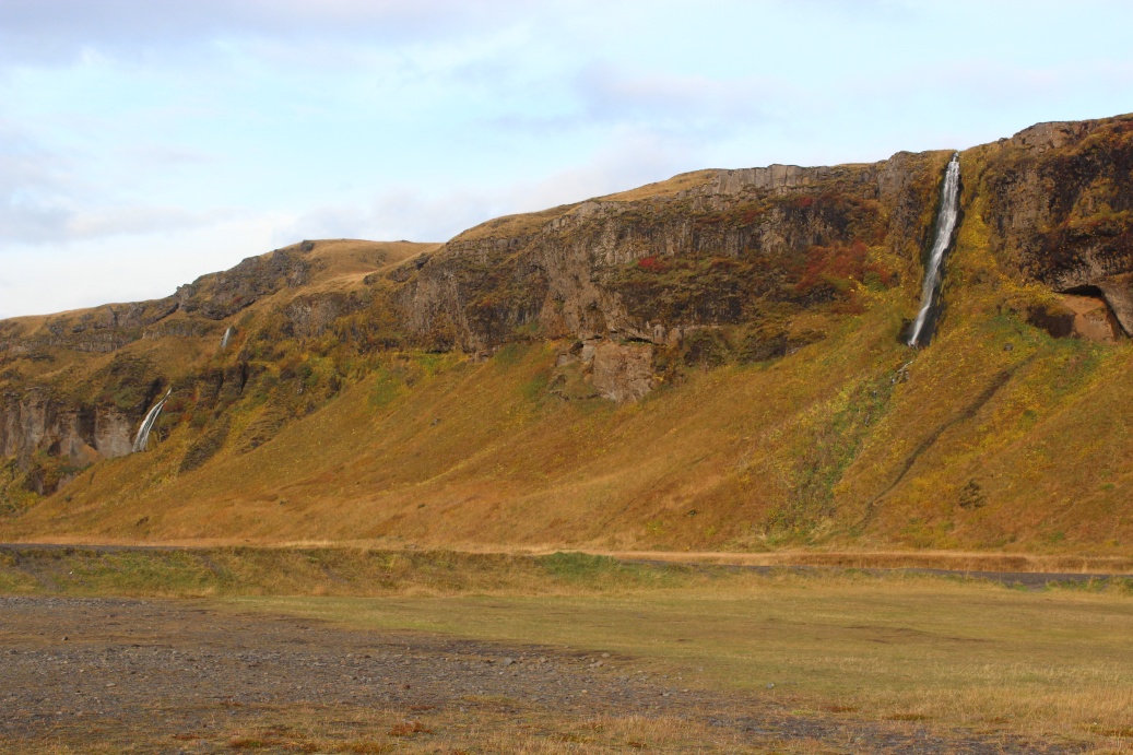
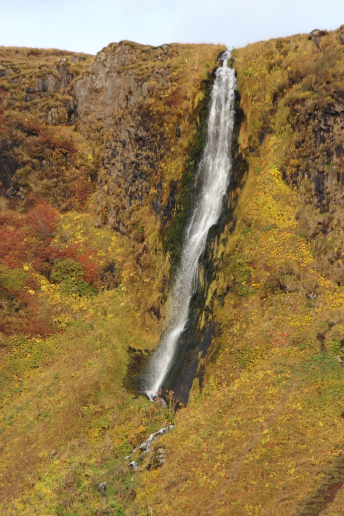
Got up to bright if hazy sunshine - this island is teasing me on my last full day! First time I properly packed tent since day one - I kept it loose on back of the car whilst travelling from site to site - did not want to pack it tight whilst it was wet. Tried to find some dryish clothes - barely succeeded! Threw all in car and headed for a side track a small distance up the F249. The track went up over the bluffs overlooking Seljalandsfoss.
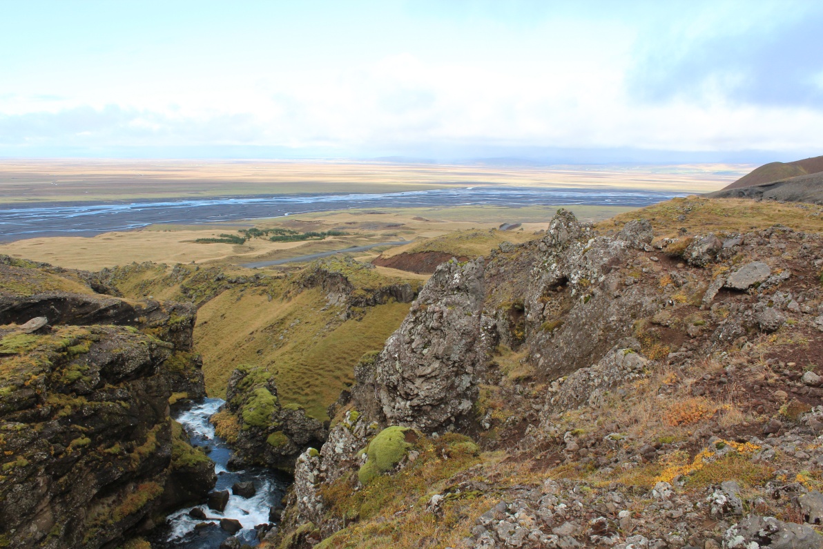
View from high above Seljalandsfoss, this river partly fed the big falls above the campsite.
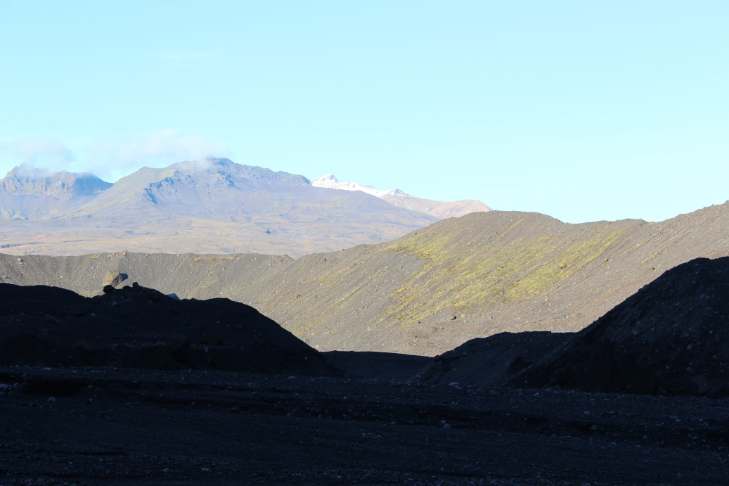
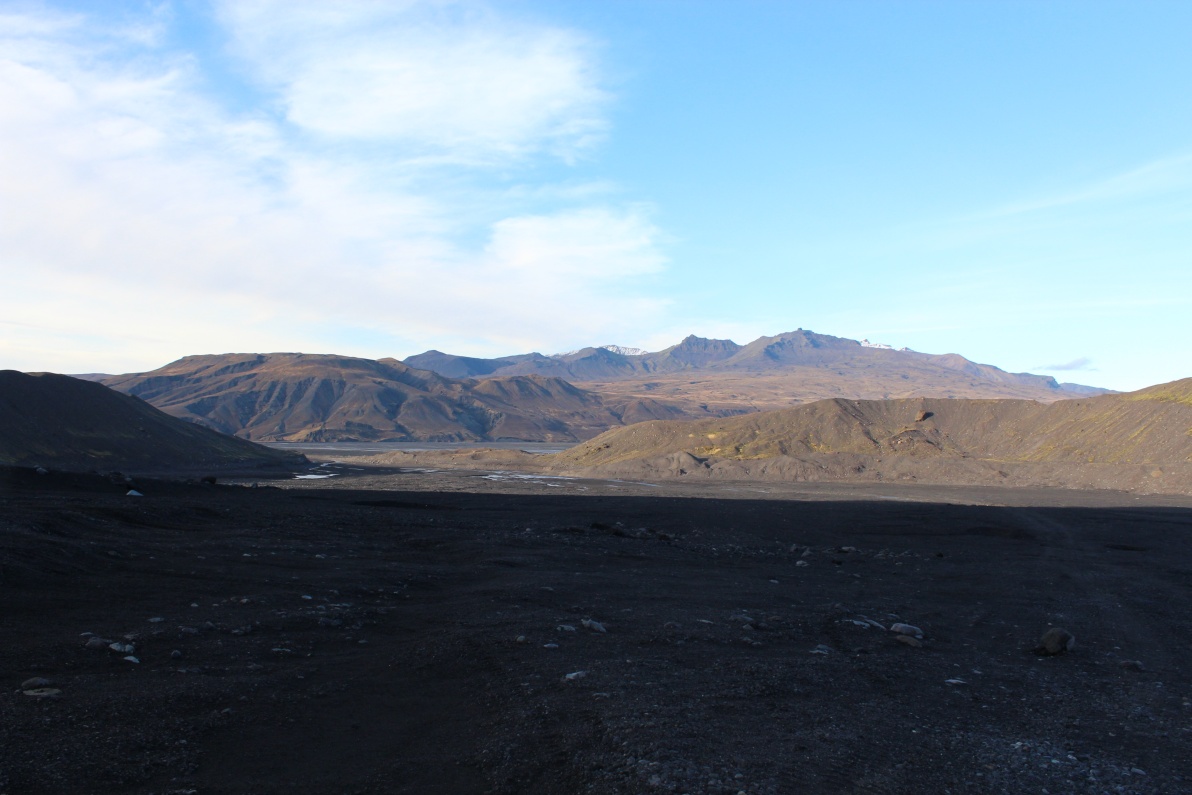
The view inland - the cloud deck is low today, or I have climbed further than I thought? The South coastal region is relatively temperate - warmed by the gulf stream.
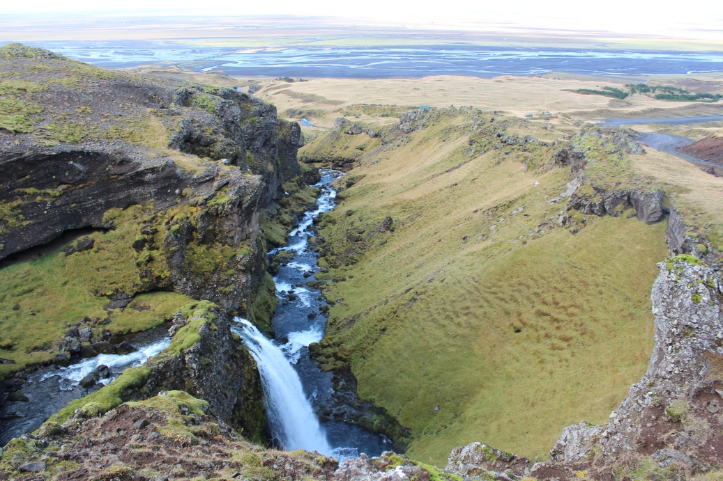
Falls further upstream feeding river that feeds falls at Seljalandsfoss.
View from the opposite slope - slightly precarious footing!
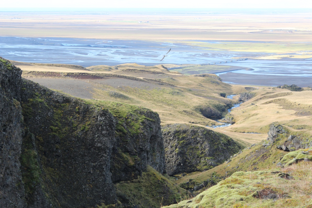
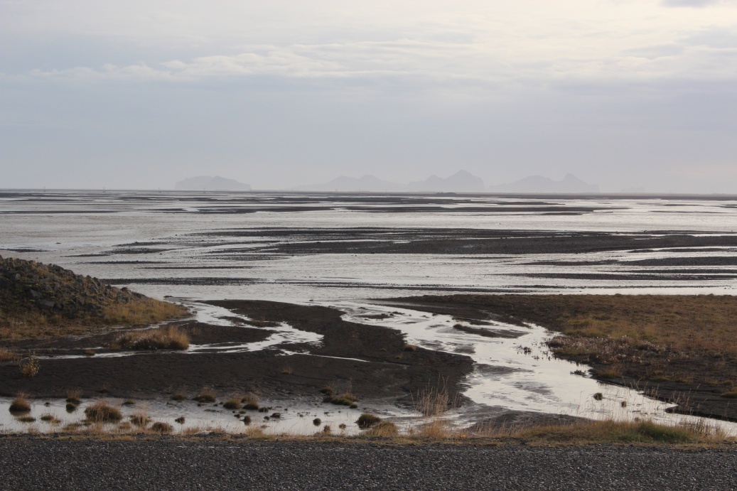
View down the gully out over the Eyjafjallajokull floodplain. N1 road bridge across the main river was destroyed in 2010 eruption. Seagull centre shot - not much other obvious wildlife here!

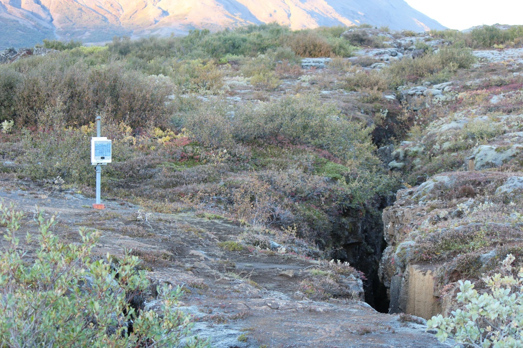
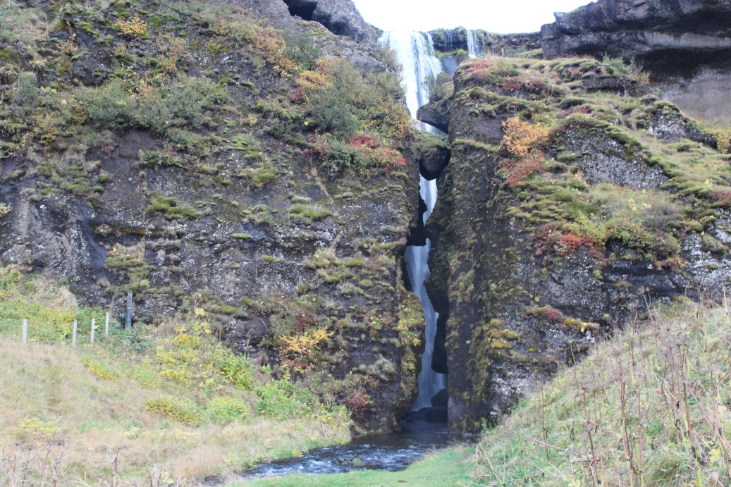
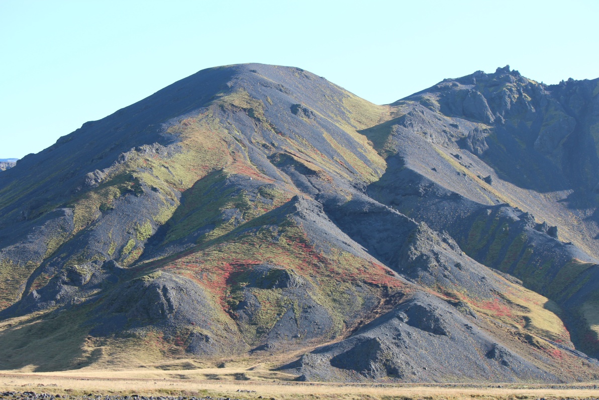
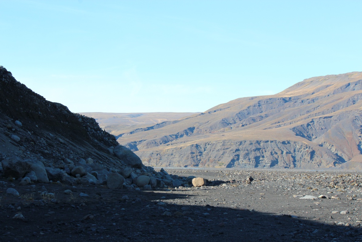
More evidence of the continental divide. The tears in the rock are spread over 100's of Km.
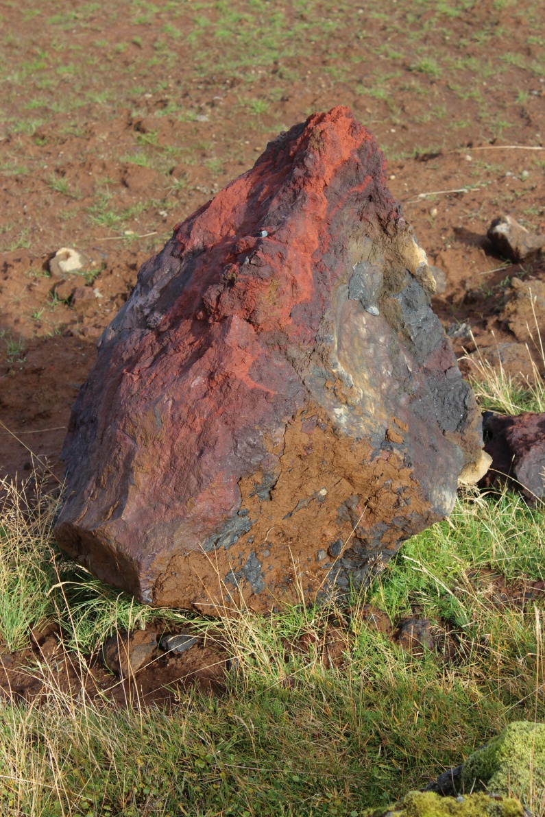
The rocks are some amazing colours.
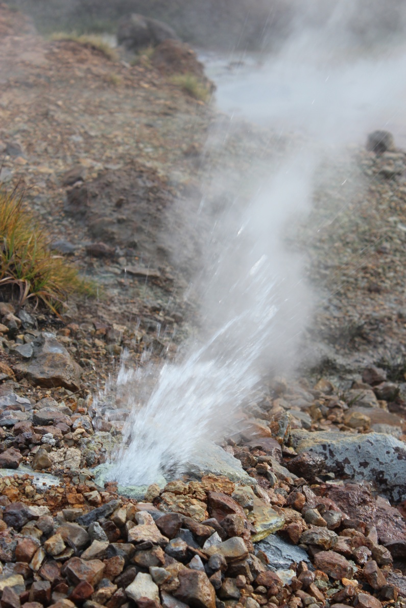
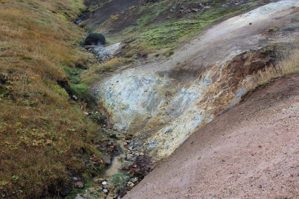
On the drive back - near Hengil I saw steam and smelt the sulphur - took a side road and found a small area of hot springs. Micro geyser above. There was a light drizzle fading in and out.
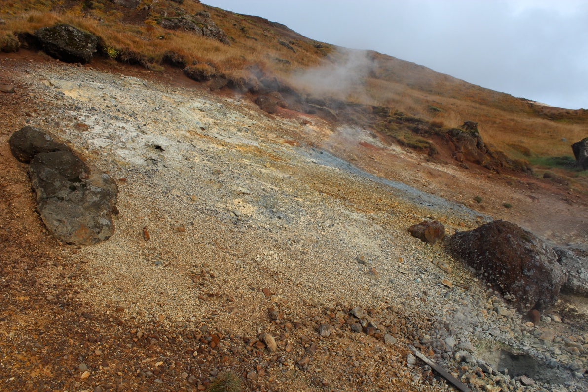
Steaming ground of many colours.
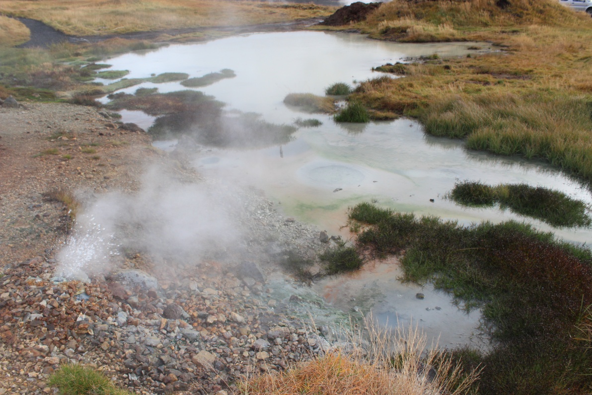
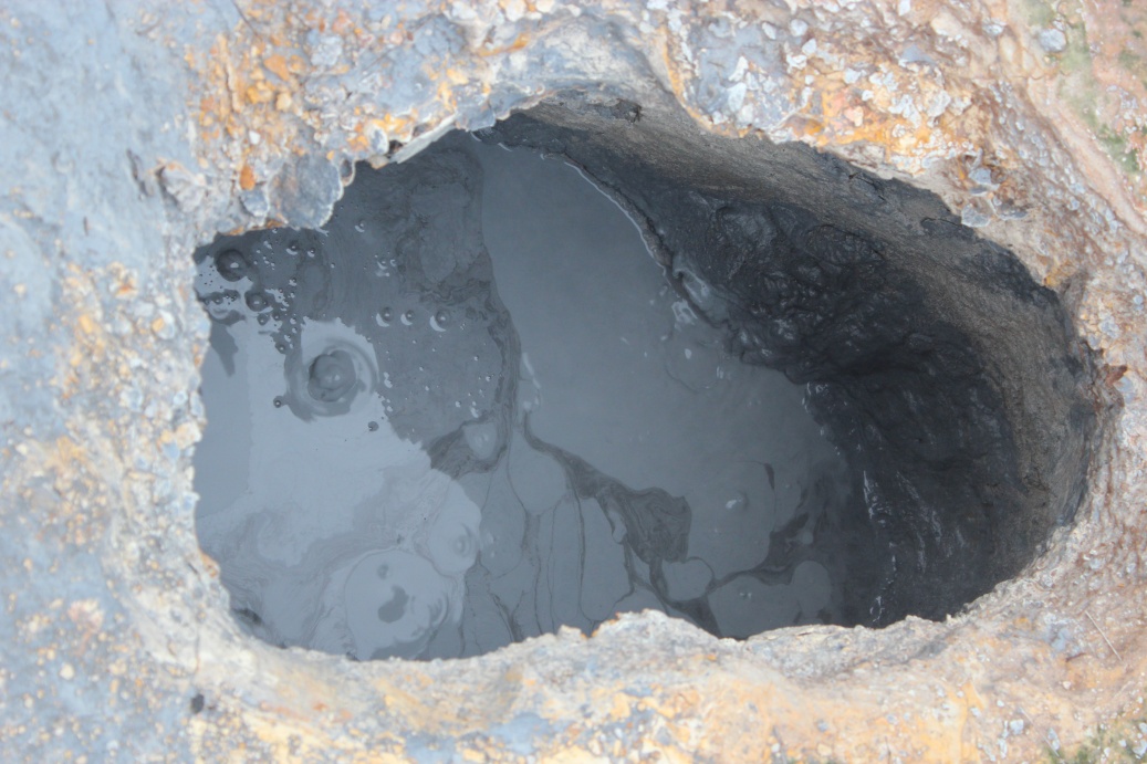
The same micro geyser feeding hot bubbling pool.
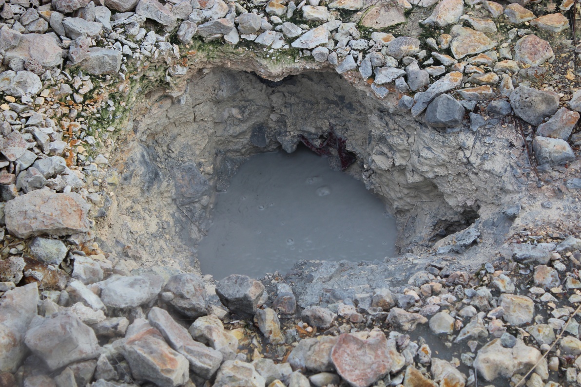
The ground was peppered with bubbling mud pools, just large enough to step in.
This one is a bit more active and a bit larger at about 1 metre across.
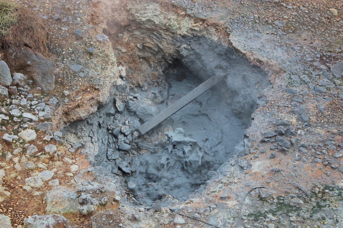
An 'oily' mudpool - not oil but looks it!
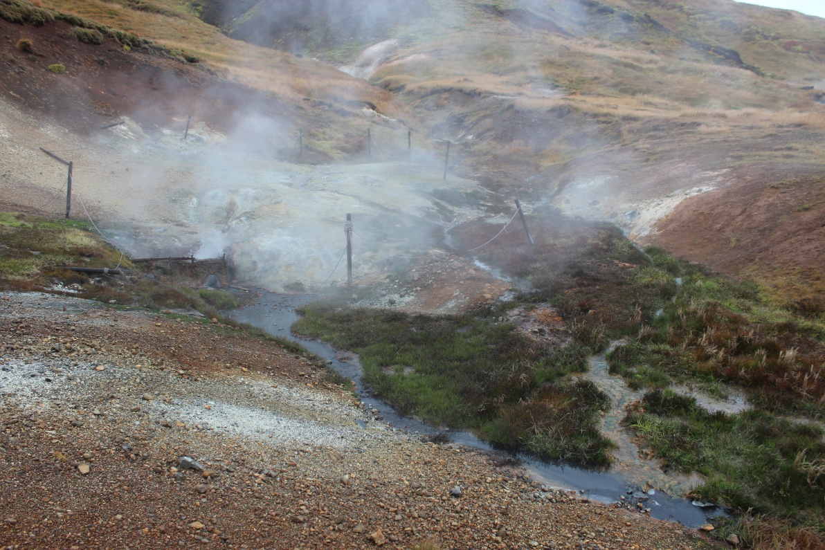
Overview of this small area of hot springs.
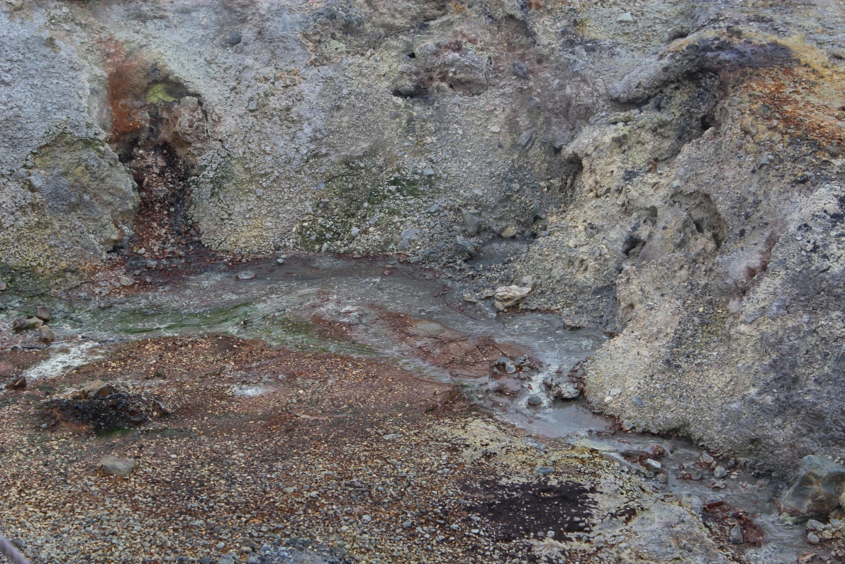
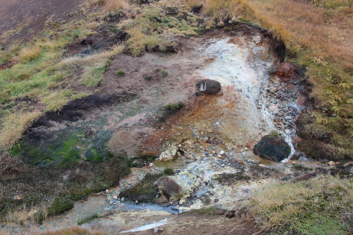
Weird coloured streams on barren toxic 'soil'.
Away from the toxins, but in the warming steam the vegetation blooms - well blooms for Iceland!
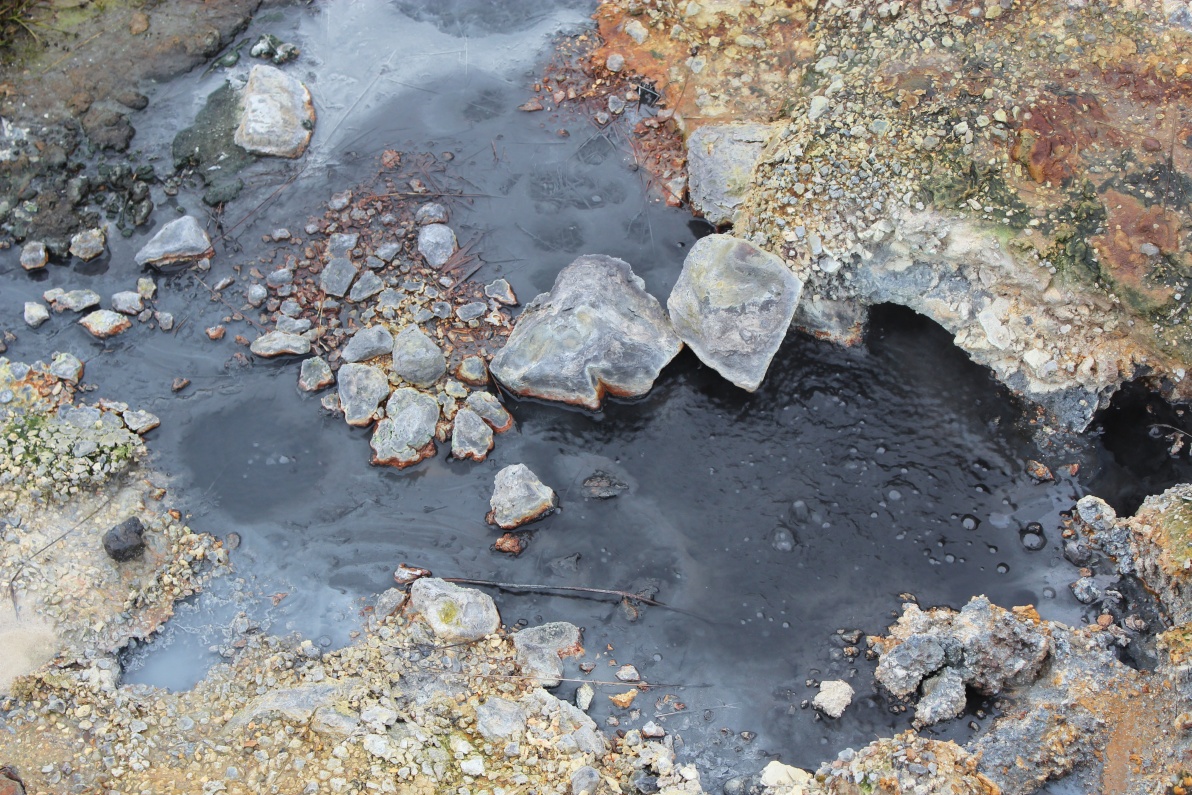
Another bubbling pool.
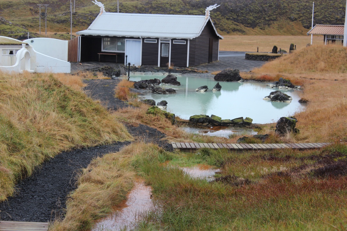
Just 100M away - how about that for an outdoor pool! I found a very expensive looking hotel just round the corner - closed of course - I suspect very busy in summer.
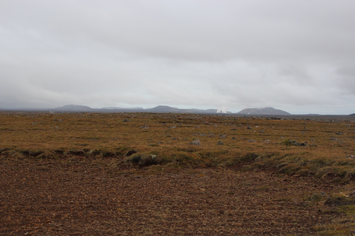
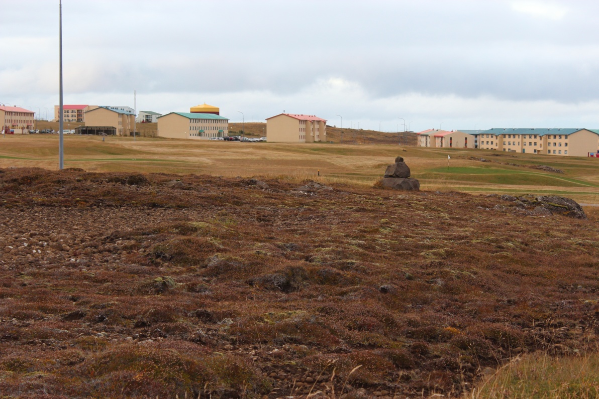
On the Reykjanes peninsular near Keflavik airport, very flat but boulder strewn area. Last views back towards the highlands and volcanoes of the last few days. Had been drizzling most of the drive back.
The old NATO base, now mostly a civilian suburb of Keflavik. The Hotel was a converted barrack block. The room was excellent - I expected something small, this was huge. The shower room was larger than some hotel rooms I have been in! The Hotel had a laundry room - so surely needed. Everything was damp again from the almost incessant drizzle - my overcoat had passed its sell-by date - it was no longer waterproof and just soaked up moisture!
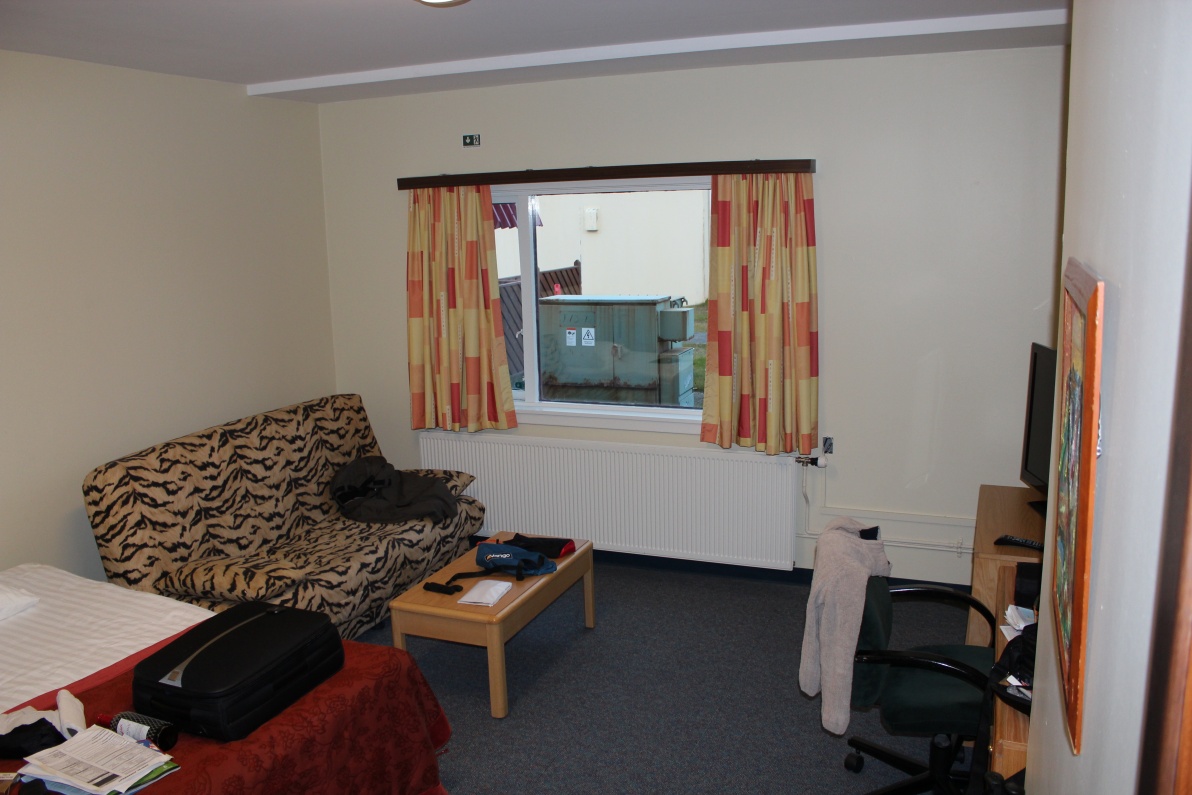
Breakfast was a huge buffet of continental & English selections, and an endless coffee and juice machine that was also available all night. My car was supposed to be collected at about 22.00 Wed' evening. By the time I had freshened up and washed and dried some clothes it was nearly 21.00 - rushed into Keflavik town (the local fast food closed at 20.00) to a foodery. This is where the satnav was useful - it had all the fooderies listed - though it seemed to have a preference for KFC, I did not! Found a small restaurant and had a local lamb and potato dish - it was lovely. That used up all but my last 500ISK, and change - I had guessed well. Tried calling the rental co' but got no answer, & he did not call me when I was late back. After a few failed phone calls the receptionist took all details, inspected the car and I gave him the keys. Adventure car rentals, where I got the 'jeep', is run by a couple of young lads and is a bit casual - no problem to me, as long as the car was good, and it did all I asked of it.
Got up at 06.30 shower and nice extended breakfast - cornflakes and cream - mmmmmm! I had packed everything the night before and was in shuttle bus at 07.30, Keflavik airport is lovely. Compact, smart and friendly.
All bags etc through security with no issues, flight was on time - I was first on board so got my favourite over wing emergency door seat. The flight was very nearly full and I dozed the whole return trip. Landed at about 13.00 UK time.
On return, I wont go into detail but I was totally pissed off with Luton airport - and would recommend anyone to pay a few £ more and use any other possible airport!
**************************************************************************************************
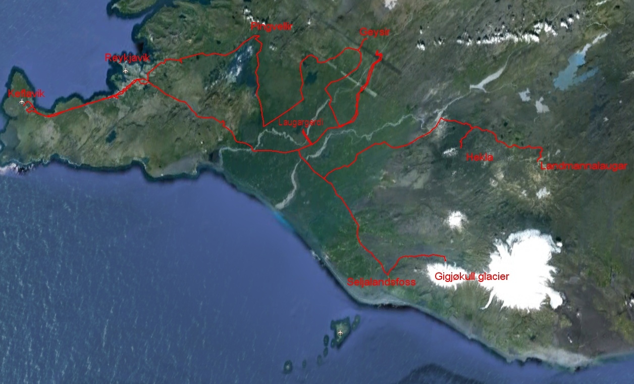
Full map of the route I took - some tracks are a bit off - and some long straight lines when total loss of sat' signals - my GPS tracker kept getting buried under debris on the car seat and losing satellite lock!
Hekla drive map Gigjokull glacier map
All in all I had a great trip despite being damp through most of the time - it was bordering on an adventure in places, this is an extreme environment even in the early autumn. I would recommend anyone to go and see these sights - though perhaps in the summer months - and there are many more I had no chance to see in the few days I was there. If you enjoy off road driving this is the place to come - rent a car and really drive it like a rental!
I learnt a lot on camping in poor climates - primarily to keep some clothes, your fuel dry, and don't think a car is a dry place! It was never colder than about 2C even at night, except on Hekla where at over 900M it was well below freezing, and on the way up/down to the Gigjøkull glacier it was near freezing in the shadows - which was the whole valley for the last Km or so! Next time I will be more prepared for the rigors of the Hekla trail - hopefully there will be a next time! It would be fun to camp at the last sheltered spot near some cliffs a few of Km up the trail to its base and have a whole day or two to get to the top.
Spent two days when back cleaning the tent and equipment of all the mud I had collected, and laundering all the clothes etc I had taken. Camera went straight into a sealed poly bag with a hand full of silica gel drying bags. On getting home my skin crawled with a reaction (I believe) to the sulphurous water in Iceland - a long shower cured that. The constant damp caused hangnails on all my fingers, and a small cut on one finger became infected. I had my first aid kit with me and liberal antiseptic kept it under control. As soon as I fully dried out the wound sealed itself in a day or so.
The final note: Whenever I go to Norway skiing I lose one or two toenails on my lil toes, I am going to lose the nail on my left lil toe after this expedition - surely a sign of a great holiday! (I am perhaps just a little odd!!!!).
Still grinning! Denis 1-10-2012.
Jump to: Day 1, Pingvellir Day 2, Geysir Day 3, Hekla Day 4, Landmannalaugar Day 5, Landmannalaugar & Seljalandsfoss Day 6, Gigjokull glacier Day 7, Hengil / Keflavik